|
search place name
|
||
Chunggang-ni (Ch'ungch'ŏng, Korea, South)Chunggang-ni is a town in the Ch'ungch'ŏng region of Korea, South. An overview map of the region around Chunggang-ni is displayed below.
regional and 3d topo map of Chunggang-ni, Korea, South ::

Chunggang-ni airports ::
The nearest airport is OSN - Osan Ab, located 67.4 km north of Chunggang-ni.
Other airports nearby include KUB - Kunsan Ab (69.7 km south), SSN - Seoul East Seoul Ab (107.2 km north), GMP - Seoul Gimpo (115.6 km north), YEC - Yechon Yecheon (141.2 km east), Nearby towns ::
Chungjo-ri (0.0km north) //
Nokp'yŏng-ni (0.2km north east) //
Simong-ni (1.9km north) //
Sajŏm (1.9km south) //
Ch'ŏndae-ri (1.7km west) //
Yŏnbongjŏng (1.7km west) //
Taesil (2.4km south west) //
Mukkye (2.4km north east) //
Widongmak (2.4km north east) //
Chungmung-ni (3.0km south) //
Tae-ri (3.4km north east) //
Kwangsi-ri (3.6km north) //
Wŏnnojŏn (3.5km north west) //
Sangsindae-ri (4.0km north) //
Andŏktari (3.5km south east) //
Wŏn-gol (4.0km south) //
Tongdal (4.8km north west) //
Yongch'ŏn-ni (4.8km south west) //
Sangsilmong-ni (4.8km north east) //
Sansŏng-ni (4.5km south west) //
Chijŏng-ni (4.5km west) //
An'gol (5.6km south) //
Hudŏk-kol (4.5km east) //
Hasimgong-ni (5.8km north) //
Sindae-ri (5.8km north) //
Urŏnae (4.8km north west) //
Yangjip'yŏn (4.8km north east) //
Taehyŏn-ni (4.8km south west) //
Ch'ŏnggye-dong (4.8km south east) //
[all distances 'as the bird flies' and approximate] 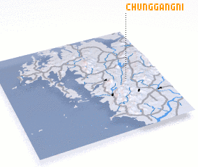 Places with similar names to Chunggang-ni, Korea, South ::
// Chang Naogaon (BD)
// Chang Noāgaon (BD)
// Changgang-ni (KP)
// Changgong-ni (KP)
// Changgung-ni (KP)
// Ch'ŏnggang-ni (KP)
// Chŏnggong-ni (KP)
// Ch'ŏn'gong-ni (KP)
// Ch'ŏngong-ni (KP)
// Chungang-ni (KP)
Disclaimer :: Information on this page comes without warranty of any kind |
||
|
Where is Chunggang-ni? Elevation and coordinates ::
Latitude (lat): 36°31'0"N Longitude (lon): 126°47'0"E
Elevation (approx.): 48m (map arrows pan, magnifying glasses zoom) |
||
|
Visiting Chunggang-ni? Hotel/Accommodation ::
Book a hotel in Chunggang-ni Travel Guide ::
rental cars ::
car rental offers GPS waypoint ::
download a GPX waypoint (PoI) of Chunggang-ni for your GPS receiver
|
||