|
search place name
|
||
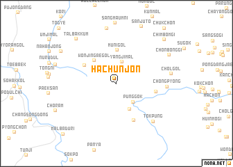
Hach'unjŏn (Kangwŏn, Korea, South)Hach'unjŏn is a town in the Kangwŏn region of Korea, South. An overview map of the region around Hach'unjŏn is displayed below.
regional and 3d topo map of Hach'unjŏn, Korea, South ::
Hach'unjŏn airports ::
The nearest airport is KAG - Kangnung Gangneung, located 68.6 km north of Hach'unjŏn.
Other airports nearby include YEC - Yechon Yecheon (90.2 km south west), SHO - Sokch'o Sokcho (119.4 km north west), KPO - Pohang (132.0 km south), TAE - Taegu Daegu Ab (146.0 km south), Nearby towns ::
Yangji-mal (3.5km north) //
P'unggok (3.7km south east) //
Ping-dong (4.5km south) //
Wŏnjin'gae-gol (4.7km north west) //
Muni-gol (5.3km north) //
Chung-ch'on (5.0km north west) //
Kalchŏn (5.3km east) //
Oesambang (6.3km south) //
Ch'ŏngp'yŏng (6.5km east) //
Tŏkp'ung (7.7km south east) //
Chagŭnjung-mal (8.9km north) //
Chŏl-gol (7.2km east) //
Talbakkum (8.8km north west) //
Chŏnbonggi (8.1km north east) //
Chimbŏmgi (9.3km north east) //
Chukchŏn (10.8km north east) //
Malbadŭri (10.6km south west) //
[all distances 'as the bird flies' and approximate]  Places with similar names to Hach'unjŏn, Korea, South ::
// Hechingen (DE)
// Houshangen (CN)
Disclaimer :: Information on this page comes without warranty of any kind |
||
|
Where is Hach'unjŏn? Elevation and coordinates ::
Latitude (lat): 37°9'14"N Longitude (lon): 129°7'51"E
Elevation (approx.): 332m (map arrows pan, magnifying glasses zoom) |
||
|
Visiting Hach'unjŏn? Hotel/Accommodation ::
Book a hotel in Hach'unjŏn Travel Guide ::
rental cars ::
car rental offers GPS waypoint ::
download a GPX waypoint (PoI) of Hach'unjŏn for your GPS receiver
|
||