|
search place name
|
||
Hongbok (Kyŏnggi, Korea, South)Hongbok is a town in the Kyŏnggi region of Korea, South. An overview map of the region around Hongbok is displayed below.
regional and 3d topo map of Hongbok, Korea, South ::

Hongbok airports ::
The nearest airport is GMP - Seoul Gimpo, located 28.7 km south west of Hongbok.
Other airports nearby include SSN - Seoul East Seoul Ab (36.6 km south), OSN - Osan Ab (74.5 km south), SHO - Sokch'o Sokcho (147.4 km east), KAG - Kangnung Gangneung (172.0 km east), Nearby towns ::
Wikkama-gol (2.5km south west) //
Tongsan-dong (3.2km south) //
Tongbu (4.3km north east) //
Songch'u-dong (5.0km south) //
Ŭijŏngbu (4.4km east) //
Changsuttol (6.2km north) //
Karaebijangt'ŏ (6.2km north) //
Hong-gol (5.7km north west) //
Kwangnŭng-mal (6.6km north) //
Kanam-ni (7.0km north) //
Tarigogae (7.1km south) //
Saemnae (6.7km north east) //
Majŏn (6.6km east) //
Koeŭm (7.6km north west) //
Moo-gol (7.0km east) //
Kyŏnjinbawi (7.9km north west) //
Ŏmsang-gol (10.3km north east) //
[all distances 'as the bird flies' and approximate] 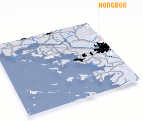 Places with similar names to Hongbok, Korea, South ::
// Whangbukai (LR)
Disclaimer :: Information on this page comes without warranty of any kind |
||
|
Where is Hongbok? Elevation and coordinates ::
Latitude (lat): 37°45'40"N Longitude (lon): 126°59'31"E
Elevation (approx.): 266m (map arrows pan, magnifying glasses zoom) |
||
|
Visiting Hongbok? Hotel/Accommodation ::
Book a hotel in Hongbok Travel Guide ::
rental cars ::
car rental offers GPS waypoint ::
download a GPX waypoint (PoI) of Hongbok for your GPS receiver
|
||