|
search place name
|
||
Hwangp'o (Kangwŏn, Korea, South)Hwangp'o is a town in the Kangwŏn region of Korea, South. An overview map of the region around Hwangp'o is displayed below.
regional and 3d topo map of Hwangp'o, Korea, South ::

Hwangp'o airports ::
The nearest airport is SHO - Sokch'o Sokcho, located 20.1 km south of Hwangp'o.
Other airports nearby include KAG - Kangnung Gangneung (72.1 km south east), SSN - Seoul East Seoul Ab (157.9 km south west), GMP - Seoul Gimpo (174.8 km south west), YEC - Yechon Yecheon (187.6 km south), Nearby towns ::
Songam-ni (1.3km south) //
Oho-ri (1.4km north) //
Sŏkkyo (2.4km north west) //
Yach'ol-li (2.5km south west) //
Munam-ni (3.2km south) //
Kyoam-ni (4.0km south) //
Konghyŏnjil-li (4.6km north west) //
Hagya-ri (4.6km south west) //
Ayajil-li (6.0km south) //
Ch'ŏnggal-li (6.9km south) //
Obong-ni (5.7km west) //
Ch'ŏnjin (7.6km south) //
Pongp'o (8.0km south) //
Towŏl-li (7.4km south west) //
Sudong-ni (8.0km north west) //
Kansŏng (9.0km north west) //
Tongho-ri (9.5km north west) //
[all distances 'as the bird flies' and approximate] 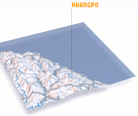 Places with similar names to Hwangp'o, Korea, South ::
// Waingapu (ID)
// Hwangp'o (KR)
// Hwangŏp'o (KP)
// Wān Hkai-pa-aw (MM)
// Wān Kawpa (MM)
// Winougap (VU)
// Wān Hkawp (MM)
// Wān Kao-paw (MM)
// Wān Kāp (MM)
// Wankapaw (MM)
Disclaimer :: Information on this page comes without warranty of any kind |
||
|
Where is Hwangp'o? Elevation and coordinates ::
Latitude (lat): 38°19'0"N Longitude (lon): 128°32'0"E
Elevation (approx.): -32768m (map arrows pan, magnifying glasses zoom) |
||
|
Visiting Hwangp'o? Hotel/Accommodation ::
Book a hotel in Hwangp'o Travel Guide ::
rental cars ::
car rental offers GPS waypoint ::
download a GPX waypoint (PoI) of Hwangp'o for your GPS receiver
|
||