|
search place name
|
||
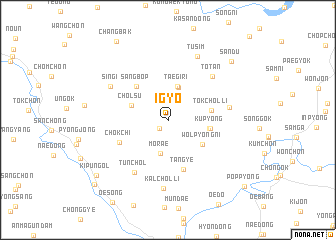
Igyo (Kyŏngsang, Korea, South)Igyo is a town in the Kyŏngsang region of Korea, South. An overview map of the region around Igyo is displayed below.
regional and 3d topo map of Igyo, Korea, South ::
Igyo airports ::
The nearest airport is RSU - Yeosu, located 73.1 km south west of Igyo.
Other airports nearby include TAE - Taegu Daegu Ab (79.8 km north east), PUS - Kimhae Gimhae Intl (90.3 km east), KWJ - Kwangju Gwangju (112.6 km west), USN - Ulsan (124.8 km east), Nearby towns ::
Sonmok (1.2km south west) //
Morae (3.8km south) //
Hanbat (3.8km north) //
Taegi-ri (3.9km north) //
Ch'ŏlsu (3.7km north west) //
Wŏlp'yŏng-ni (4.1km south east) //
Hambang-ni (3.9km east) //
Kup'yŏng (4.0km east) //
Tŏkch'ol-li (4.1km east) //
Sangbŏp (4.8km north west) //
Tan'gye (5.7km south) //
Ch'ŏkchi (5.0km south west) //
Tunch'ŏl (6.5km south west) //
Tot'an (6.4km north east) //
Changdae (5.8km east) //
Sin'gi (6.4km north west) //
Kalchŏl-li (7.7km south) //
Tusim (7.6km north) //
Sandu (8.8km north east) //
Kip'un-gol (9.0km south west) //
Changbak (9.9km north west) //
Samgŏ (9.8km south west) //
Pŏpp'yŏng (10.1km south east) //
[all distances 'as the bird flies' and approximate] 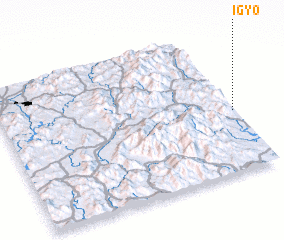 Places with similar names to Igyo, Korea, South ::
Disclaimer :: Information on this page comes without warranty of any kind |
||
|
Where is Igyo? Elevation and coordinates ::
Latitude (lat): 35°25'29"N Longitude (lon): 127°59'29"E
Elevation (approx.): 263m (map arrows pan, magnifying glasses zoom) |
||
|
Visiting Igyo? Hotel/Accommodation ::
Book a hotel in Igyo Travel Guide ::
rental cars ::
car rental offers GPS waypoint ::
download a GPX waypoint (PoI) of Igyo for your GPS receiver
|
||