|
search place name
|
||
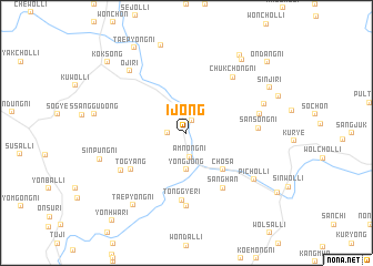
Ijŏng (Korea, South)Ijŏng is a town in Korea, South. An overview map of the region around Ijŏng is displayed below.
regional and 3d topo map of Ijŏng, Korea, South ::
Ijŏng airports ::
The nearest airport is RSU - Yeosu, located 47.4 km south east of Ijŏng.
Other airports nearby include KWJ - Kwangju Gwangju (51.8 km west), KUB - Kunsan Ab (102.2 km north west), TAE - Taegu Daegu Ab (139.2 km north east), PUS - Kimhae Gimhae Intl (143.2 km east), Nearby towns ::
Tuga-ri (1.3km north) //
Sobong (1.5km west) //
Amnong-ni (2.4km south) //
Yongjŏng (3.7km south) //
Chosa (4.8km south east) //
Sanghan (6.3km south east) //
Tŏgyang (5.9km south west) //
Tonggye-ri (6.8km south) //
Sansŏng-ni (5.9km east) //
Chukchŏng-ni (6.8km north east) //
Tonggye (7.4km south) //
Pongjŏng-ni (6.5km south west) //
Tu-dong (6.3km east) //
Pich'ol-li (7.3km south east) //
Yonggang-ni (7.0km north east) //
Oji-ri (7.8km north west) //
T'aep'yŏng-ni (8.5km south west) //
Sinp'ung-ni (7.6km west) //
Moktong-ni (9.1km north) //
Paech'on (8.7km north east) //
Ip'yŏng-ni (8.9km north east) //
Sinji-ri (8.2km north east) //
Taep'yŏng-ni (9.6km north west) //
Koksŏng (9.6km north west) //
Ondang-ni (9.7km north east) //
Yŏnhwa-ri (10.8km south west) //
[all distances 'as the bird flies' and approximate]  Places with similar names to Ijŏng, Korea, South ::
Disclaimer :: Information on this page comes without warranty of any kind |
||
|
Where is Ijŏng? Elevation and coordinates ::
Latitude (lat): 35°13'0"N Longitude (lon): 127°22'0"E
Elevation (approx.): 56m (map arrows pan, magnifying glasses zoom) |
||
|
Visiting Ijŏng? Hotel/Accommodation ::
Book a hotel in Ijŏng Travel Guide ::
rental cars ::
car rental offers GPS waypoint ::
download a GPX waypoint (PoI) of Ijŏng for your GPS receiver
|
||