|
search place name
|
||
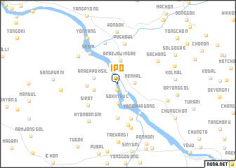
Ip'o (Kyŏnggi, Korea, South)Ip'o is a town in the Kyŏnggi region of Korea, South. An overview map of the region around Ip'o is displayed below.
regional and 3d topo map of Ip'o, Korea, South ::
Ip'o airports ::
The nearest airport is SSN - Seoul East Seoul Ab, located 37.8 km west of Ip'o.
Other airports nearby include OSN - Osan Ab (55.9 km south west), GMP - Seoul Gimpo (68.4 km west), YEC - Yechon Yecheon (111.5 km south east), SHO - Sokch'o Sokcho (125.4 km north east), Nearby towns ::
Ch'ŏnyang (0.9km south) //
Men-mal (2.1km east) //
Sŏkkyeul (3.1km south) //
Araejajin'gae (3.8km north) //
Araeppŏm-sil (3.2km west) //
Changhŭng-ni (3.2km west) //
Changhŭng (4.0km west) //
Hada-ri (5.4km south) //
Sirat (5.0km south west) //
Yanghwa-dong (5.4km south east) //
Kwirae-dong (5.8km south) //
Puch'ŏul (6.5km north) //
Sesim (6.1km north west) //
Ŏkkyo-dong (6.6km south) //
Toltam (6.7km north) //
Hyoji (7.2km south) //
Sach'ang (6.2km north east) //
Hyŏnbang-ni (7.0km south west) //
Taegam (6.6km north west) //
An-mal (6.8km south east) //
Wŏndŏk (8.3km north) //
Yŏnyang (8.2km north west) //
[all distances 'as the bird flies' and approximate] 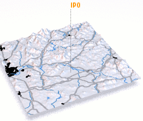 Places with similar names to Ip'o, Korea, South ::
Disclaimer :: Information on this page comes without warranty of any kind |
||
|
Where is Ip'o? Elevation and coordinates ::
Latitude (lat): 37°23'30"N Longitude (lon): 127°32'6"E
Elevation (approx.): 51m (map arrows pan, magnifying glasses zoom) |
||
|
Visiting Ip'o? Hotel/Accommodation ::
Book a hotel in Ip'o Travel Guide ::
rental cars ::
car rental offers GPS waypoint ::
download a GPX waypoint (PoI) of Ip'o for your GPS receiver
|
||