|
search place name
|
||
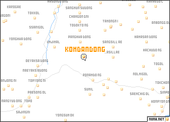
Kŏmdan-dong (Kangwŏn, Korea, South)Kŏmdan-dong is a town in the Kangwŏn region of Korea, South. An overview map of the region around Kŏmdan-dong is displayed below.
regional and 3d topo map of Kŏmdan-dong, Korea, South ::
Kŏmdan-dong airports ::
The nearest airport is SSN - Seoul East Seoul Ab, located 79.9 km south west of Kŏmdan-dong.
Other airports nearby include GMP - Seoul Gimpo (85.7 km south west), SHO - Sokch'o Sokcho (98.4 km east), OSN - Osan Ab (119.4 km south), KAG - Kangnung Gangneung (134.7 km east), Nearby towns ::
Panghwa-dong (4.3km north) //
Pŏnam-dong (4.4km south) //
Hasillae (5.0km east) //
Sach'ang-ni (5.7km south east) //
Haek-kol (6.1km south east) //
Todŏk-tong (6.9km north) //
Sangsillae (5.8km north east) //
Sumil (7.3km south) //
Ŭmji-mal (6.2km north west) //
Myŏndae-dong (7.1km south east) //
Nuktong (7.6km north east) //
Yŏu-gol (7.0km south east) //
Hwaŭm-dong (8.1km south east) //
Chamgong-ni (8.7km north) //
Haebangch'on (8.6km north east) //
Tamong-ni (8.9km north east) //
Sinsul-tong (8.7km north west) //
Songjŏng-dong (8.9km south east) //
Changje-dong (10.2km north east) //
[all distances 'as the bird flies' and approximate] 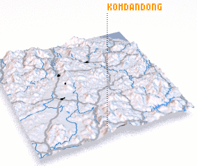 Places with similar names to Kŏmdan-dong, Korea, South ::
// Kŏmdan-dong (KR)
// Kŭmdan-dong (KR)
Disclaimer :: Information on this page comes without warranty of any kind |
||
|
Where is Kŏmdan-dong? Elevation and coordinates ::
Latitude (lat): 38°6'20"N Longitude (lon): 127°28'39"E
Elevation (approx.): 444m (map arrows pan, magnifying glasses zoom) |
||
|
Visiting Kŏmdan-dong? Hotel/Accommodation ::
Book a hotel in Kŏmdan-dong Travel Guide ::
rental cars ::
car rental offers GPS waypoint ::
download a GPX waypoint (PoI) of Kŏmdan-dong for your GPS receiver
|
||