|
search place name
|
||
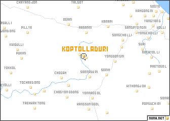
Koptolladŭ-ri (Kangwŏn, Korea, South)Koptolladŭ-ri is a town in the Kangwŏn region of Korea, South. An overview map of the region around Koptolladŭ-ri is displayed below.
regional and 3d topo map of Koptolladŭ-ri, Korea, South ::
Koptolladŭ-ri airports ::
The nearest airport is SHO - Sokch'o Sokcho, located 17.9 km north east of Koptolladŭ-ri.
Other airports nearby include KAG - Kangnung Gangneung (49.7 km south east), SSN - Seoul East Seoul Ab (135.8 km south west), YEC - Yechon Yecheon (153.4 km south), GMP - Seoul Gimpo (157.1 km west), Nearby towns ::
Sŏlp'ibat (0.7km north) //
Chindong-ni (1.6km north west) //
Soenadŭ-ri (3.7km south) //
Sŏrim (4.9km south east) //
Masan-ni (6.2km north) //
Chŏgam (5.6km south west) //
Yŏngdŏng-ni (5.2km east) //
Yŏn'gal-li (6.2km south west) //
Yŏnnae-gol (8.4km south) //
Kongsujŏl-li (7.0km north east) //
Oga-ri (8.5km north) //
Chogyŏng-dong (8.7km south) //
Karap'i (8.5km north east) //
Songch'ŏl-li (8.0km north east) //
[all distances 'as the bird flies' and approximate] 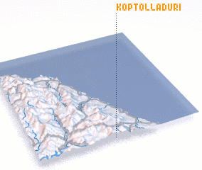 Places with similar names to Koptolladŭ-ri, Korea, South :: Disclaimer :: Information on this page comes without warranty of any kind |
||
|
Where is Koptolladŭ-ri? Elevation and coordinates ::
Latitude (lat): 38°0'39"N Longitude (lon): 128°28'50"E
Elevation (approx.): 722m (map arrows pan, magnifying glasses zoom) |
||
|
Visiting Koptolladŭ-ri? Hotel/Accommodation ::
Book a hotel in Koptolladŭ-ri Travel Guide ::
rental cars ::
car rental offers GPS waypoint ::
download a GPX waypoint (PoI) of Koptolladŭ-ri for your GPS receiver
|
||