|
search place name
|
||
Kŭmjang (Chŏlla, Korea, South)Kŭmjang is a town in the Chŏlla region of Korea, South. An overview map of the region around Kŭmjang is displayed below.
regional and 3d topo map of Kŭmjang, Korea, South ::

Kŭmjang airports ::
The nearest airport is RSU - Yeosu, located 61.2 km north east of Kŭmjang.
Other airports nearby include KWJ - Kwangju Gwangju (83.1 km north west), CJU - Cheju Jeju Intl (120.0 km south west), KUB - Kunsan Ab (170.2 km north), PUS - Kimhae Gimhae Intl (182.0 km north east), Nearby towns ::
Ukkŭm (1.4km west) //
Ongnyong (3.4km west) //
Sŏkkyo (3.9km north west) //
Hongnyŏng (4.4km north east) //
Taehŭng-ni (4.3km north west) //
Och'ŏl-li (4.1km east) //
Tongjŏng (5.0km north) //
Yŏnso (4.3km west) //
Tongch'on (4.2km east) //
Sŏkchŏng-ni (5.1km north) //
Sinjŏn-ni (4.6km west) //
Ŏjŏl-li (4.6km west) //
Oryuch'on (4.8km east) //
Ch'ŏngsŏkkŭm (5.0km east) //
Sinch'ol-li (5.5km north west) //
Wŏlp'o (6.2km north east) //
Kŭmjin (6.6km north west) //
Udu (6.1km west) //
Sinyang (6.4km north west) //
Myŏngch'ŏn (6.6km north east) //
Sinp'yŏng-ni (7.0km north east) //
[all distances 'as the bird flies' and approximate] 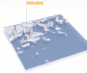 Places with similar names to Kŭmjang, Korea, South ::
Disclaimer :: Information on this page comes without warranty of any kind |
||
|
Where is Kŭmjang? Elevation and coordinates ::
Latitude (lat): 34°26'14"N Longitude (lon): 127°9'52"E
Elevation (approx.): 31m (map arrows pan, magnifying glasses zoom) |
||
|
Visiting Kŭmjang? Hotel/Accommodation ::
Book a hotel in Kŭmjang Travel Guide ::
rental cars ::
car rental offers GPS waypoint ::
download a GPX waypoint (PoI) of Kŭmjang for your GPS receiver
|
||