|
search place name
|
||
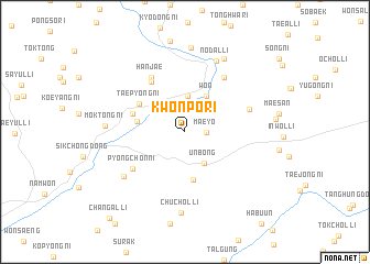
Kwonp'o-ri (Chŏlla, Korea, South)Kwonp'o-ri is a town in the Chŏlla region of Korea, South. An overview map of the region around Kwonp'o-ri is displayed below.
regional and 3d topo map of Kwonp'o-ri, Korea, South ::
Kwonp'o-ri airports ::
The nearest airport is RSU - Yeosu, located 69.9 km south of Kwonp'o-ri.
Other airports nearby include KWJ - Kwangju Gwangju (74.4 km south west), KUB - Kunsan Ab (94.6 km north west), TAE - Taegu Daegu Ab (114.0 km north east), PUS - Kimhae Gimhae Intl (133.4 km east), Nearby towns ::
Maeyo (1.8km east) //
Wŏlsŏng-ni (3.7km north) //
Unbong (3.6km south east) //
Wŏn (4.1km north east) //
Haengjŏng-ni (4.9km south) //
Pujŏl-li (4.1km west) //
T'aep'yŏng-ni (4.7km north west) //
Sinp'ung (4.6km north west) //
Taesang-ni (5.8km north west) //
P'yŏngch'on-ni (5.7km south west) //
Hanjae (6.2km north west) //
Nonsil (6.4km north east) //
Agong-ni (5.8km north east) //
Kwarim-ni (6.8km south west) //
Nodal-li (7.6km north) //
Moktong-ni (6.6km west) //
Chuch'ol-li (8.2km south) //
Chungnim (8.1km north east) //
Chuksal-li (8.5km north) //
Changal-li (10.8km south west) //
[all distances 'as the bird flies' and approximate]  Places with similar names to Kwonp'o-ri, Korea, South ::
// Kwanp'o-ri (KR)
Disclaimer :: Information on this page comes without warranty of any kind |
||
|
Where is Kwonp'o-ri? Elevation and coordinates ::
Latitude (lat): 35°28'1"N Longitude (lon): 127°30'50"E
Elevation (approx.): 488m (map arrows pan, magnifying glasses zoom) |
||
|
Visiting Kwonp'o-ri? Hotel/Accommodation ::
Book a hotel in Kwonp'o-ri Travel Guide ::
rental cars ::
car rental offers GPS waypoint ::
download a GPX waypoint (PoI) of Kwonp'o-ri for your GPS receiver
|
||