|
search place name
|
||
Myŏngho (Kyŏngsang, Korea, South)Myŏngho is a town in the Kyŏngsang region of Korea, South. An overview map of the region around Myŏngho is displayed below.
regional and 3d topo map of Myŏngho, Korea, South ::

Myŏngho airports ::
The nearest airport is YEC - Yechon Yecheon, located 54.7 km south west of Myŏngho.
Other airports nearby include KAG - Kangnung Gangneung (99.5 km north), KPO - Pohang (107.3 km south east), TAE - Taegu Daegu Ab (109.1 km south), SHO - Sokch'o Sokcho (145.1 km north), Nearby towns ::
Kogye (1.9km south) //
Sam-dong (2.2km north east) //
Kogam (3.8km west) //
Twissil (5.7km south) //
K'ŭn-mal (6.1km north) //
Saet'ŏ (6.5km north east) //
Konŭlmi (6.4km north east) //
Saegol (6.1km east) //
Okch'ŏnt'ŏ (7.2km north east) //
Myo-gol (6.7km south east) //
Hyŏn-dong (7.1km south east) //
Kalbang (7.9km north west) //
Yangsam (8.6km south) //
Silla (7.9km south west) //
Tugye-gol (8.8km south east) //
Noru-gol (8.9km north east) //
Irŭmsil (9.4km south east) //
In'gŭm (9.4km south east) //
Chigyŏng (10.1km south west) //
[all distances 'as the bird flies' and approximate] 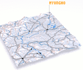
Disclaimer :: Information on this page comes without warranty of any kind |
||
|
Where is Myŏngho? Elevation and coordinates ::
Latitude (lat): 36°51'28"N Longitude (lon): 128°53'57"E
Elevation (approx.): 224m (map arrows pan, magnifying glasses zoom) |
||
|
Visiting Myŏngho? Hotel/Accommodation ::
Book a hotel in Myŏngho Travel Guide ::
rental cars ::
car rental offers GPS waypoint ::
download a GPX waypoint (PoI) of Myŏngho for your GPS receiver
|
||