|
search place name
|
||
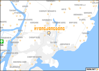
Myŏngjang-dong (Pusan, Korea, South)Myŏngjang-dong is a town in the Pusan region of Korea, South. An overview map of the region around Myŏngjang-dong is displayed below.
regional and 3d topo map of Myŏngjang-dong, Korea, South ::
Myŏngjang-dong airports ::
The nearest airport is PUS - Kimhae Gimhae Intl, located 14.9 km west of Myŏngjang-dong.
Other airports nearby include USN - Ulsan (49.3 km north east), TAE - Taegu Daegu Ab (86.8 km north west), KPO - Pohang (92.1 km north), TSJ - Tsushima (103.7 km south), Nearby towns ::
Kŭmsa-dong (1.9km north) //
Tongnae (1.5km west) //
Onch'ŏn-ni (2.4km north west) //
Onch'ŏn-il-tong (2.4km north west) //
Panyŏ-dong (3.1km north east) //
Changjŏn-dong (4.0km north) //
Suyŏng (4.0km south) //
Pugok-tong (4.5km north) //
Kusŏ-dong (4.8km north) //
Millak-tong (4.6km south east) //
Tongdae-dong (4.8km north east) //
Ch'oŭp-tong (4.9km west) //
Kwangan-dong (5.8km south) //
Konghae (5.9km north west) //
Mandŏk-tong (5.9km west) //
Haeundae (6.7km south east) //
Ch'ŏngnyong-dong (8.1km north) //
Wayŏ (9.8km north east) //
[all distances 'as the bird flies' and approximate] 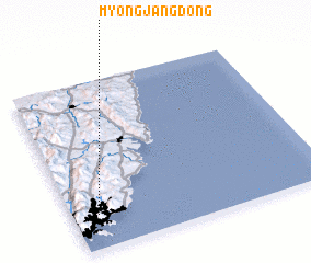 Places with similar names to Myŏngjang-dong, Korea, South ::
// Myŏngjŏng-dong (KP)
// Myŏngjŏng-dong (KR)
Disclaimer :: Information on this page comes without warranty of any kind |
||
|
Where is Myŏngjang-dong? Elevation and coordinates ::
Latitude (lat): 35°12'0"N Longitude (lon): 129°6'0"E
Elevation (approx.): 11m (map arrows pan, magnifying glasses zoom) |
||
|
Visiting Myŏngjang-dong? Hotel/Accommodation ::
Book a hotel in Myŏngjang-dong Travel Guide ::
rental cars ::
car rental offers GPS waypoint ::
download a GPX waypoint (PoI) of Myŏngjang-dong for your GPS receiver
|
||