|
search place name
|
||
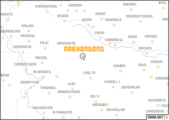
Naewŏn-dong (Kyŏngsang, Korea, South)Naewŏn-dong is a town in the Kyŏngsang region of Korea, South. An overview map of the region around Naewŏn-dong is displayed below.
regional and 3d topo map of Naewŏn-dong, Korea, South ::
Naewŏn-dong airports ::
The nearest airport is KPO - Pohang, located 52.1 km south east of Naewŏn-dong.
Other airports nearby include TAE - Taegu Daegu Ab (74.8 km south west), YEC - Yechon Yecheon (78.0 km west), USN - Ulsan (92.6 km south), PUS - Kimhae Gimhae Intl (139.0 km south), Nearby towns ::
Chŏlt'ŏ (4.2km south) //
Pŏkku-dong (4.0km north west) //
Taeam (5.7km north east) //
Nakp'yŏng (5.8km north east) //
Ijŏn (6.8km south) //
Chibu-gol (6.0km south west) //
Chanbŏdŭl (6.5km north east) //
Chaegok-tong (7.6km north) //
Wŏnap (7.9km north) //
Widibam (6.8km east) //
Chusal-li (7.8km south east) //
Anbŏpsu-dong (8.7km south) //
Talgi (7.6km west) //
Imugok (9.5km north west) //
Sŏdangma (9.4km north east) //
Tang-maŭl (9.7km south west) //
[all distances 'as the bird flies' and approximate] 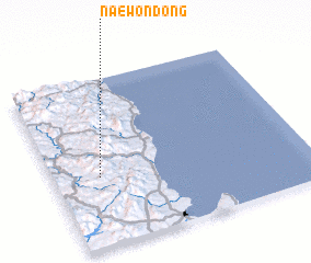 Places with similar names to Naewŏn-dong, Korea, South ::
Disclaimer :: Information on this page comes without warranty of any kind |
||
|
Where is Naewŏn-dong? Elevation and coordinates ::
Latitude (lat): 36°25'0"N Longitude (lon): 129°11'0"E
Elevation (approx.): 507m (map arrows pan, magnifying glasses zoom) |
||
|
Visiting Naewŏn-dong? Hotel/Accommodation ::
Book a hotel in Naewŏn-dong Travel Guide ::
rental cars ::
car rental offers GPS waypoint ::
download a GPX waypoint (PoI) of Naewŏn-dong for your GPS receiver
|
||