|
search place name
|
||
Norimat (Kyŏngsang, Korea, South)Norimat is a town in the Kyŏngsang region of Korea, South. An overview map of the region around Norimat is displayed below.
regional and 3d topo map of Norimat, Korea, South ::

Norimat airports ::
The nearest airport is TAE - Taegu Daegu Ab, located 35.8 km south west of Norimat.
Other airports nearby include KPO - Pohang (56.4 km east), YEC - Yechon Yecheon (66.4 km north west), USN - Ulsan (79.8 km south east), PUS - Kimhae Gimhae Intl (111.4 km south), Nearby towns ::
Yangji (1.7km south west) //
Nondŭl (1.8km south east) //
Mŏne (2.1km south west) //
Chorak (2.3km north west) //
Punjae-gol (4.1km south) //
Kŭmo-ri (5.0km north east) //
T'aeam (6.7km south west) //
Tŭngp'yŏng (7.2km north west) //
Pullo-dong (6.4km north east) //
Ha-ri (6.6km north east) //
Tusu-gol (7.8km north east) //
K'ŭn-gol (8.7km north) //
Chukchŏn (7.6km south east) //
Ch'ŏkhwa (7.5km west) //
Kujŏl-li (9.0km south) //
Ha-ri (8.9km north west) //
Pinggye (8.9km north west) //
Chach'ŏn (10.6km south east) //
[all distances 'as the bird flies' and approximate] 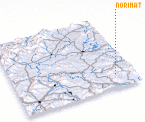 Places with similar names to Norimat, Korea, South ::
// Narmada (CM)
// Néa Roúmata (GR)
// Nurmetu (EE)
// Nermed (RO)
// Nirmata (IN)
// Narmada (ID)
// Nurumbet (KZ)
// Narimbet (UZ)
// Nārmad (IR)
// Gnéréamadia (GN)
Disclaimer :: Information on this page comes without warranty of any kind |
||
|
Where is Norimat? Elevation and coordinates ::
Latitude (lat): 36°10'51"N Longitude (lon): 128°50'29"E
Elevation (approx.): 260m (map arrows pan, magnifying glasses zoom) |
||
|
Visiting Norimat? Hotel/Accommodation ::
Book a hotel in Norimat Travel Guide ::
rental cars ::
car rental offers GPS waypoint ::
download a GPX waypoint (PoI) of Norimat for your GPS receiver
|
||