|
search place name
|
||
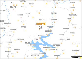
Onhye (Kyŏngsang, Korea, South)Onhye is a town in the Kyŏngsang region of Korea, South. An overview map of the region around Onhye is displayed below.
regional and 3d topo map of Onhye, Korea, South ::
Onhye airports ::
The nearest airport is YEC - Yechon Yecheon, located 44.7 km west of Onhye.
Other airports nearby include TAE - Taegu Daegu Ab (96.3 km south), KPO - Pohang (99.6 km south east), KAG - Kangnung Gangneung (111.8 km north), USN - Ulsan (136.5 km south), Nearby towns ::
Chung-maŭl (0.6km west) //
Kal-gol (2.9km north west) //
Chigyŏng (3.4km north) //
Hagye (3.5km south east) //
Punch'ŏn-dong (3.9km south) //
Wŏnch'on (3.5km south east) //
Paegun (3.4km east) //
Yean (5.8km south) //
Changkkultaengi (5.4km south west) //
Sinjŏng-ni (6.3km north west) //
Saet'ŏ (5.6km west) //
Yangsam (6.0km north east) //
Pangsin (5.9km west) //
Silla (7.5km north) //
Sagŭmak (6.8km west) //
Saemi (7.6km north west) //
Twissil (8.0km north east) //
Chisam (8.6km south) //
Pojae (8.6km south west) //
Pat-maŭl (10.1km south east) //
[all distances 'as the bird flies' and approximate]  Places with similar names to Onhye, Korea, South ::
Disclaimer :: Information on this page comes without warranty of any kind |
||
|
Where is Onhye? Elevation and coordinates ::
Latitude (lat): 36°45'0"N Longitude (lon): 128°50'0"E
Elevation (approx.): 201m (map arrows pan, magnifying glasses zoom) |
||
|
Visiting Onhye? Hotel/Accommodation ::
Book a hotel in Onhye Travel Guide ::
rental cars ::
car rental offers GPS waypoint ::
download a GPX waypoint (PoI) of Onhye for your GPS receiver
|
||