|
search place name
|
||
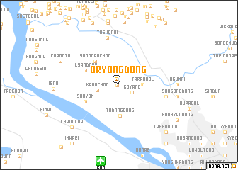
Oryong-dong (Kyŏnggi, Korea, South)Oryong-dong is a town in the Kyŏnggi region of Korea, South. An overview map of the region around Oryong-dong is displayed below.
regional and 3d topo map of Oryong-dong, Korea, South ::
Oryong-dong airports ::
The nearest airport is GMP - Seoul Gimpo, located 12.2 km south of Oryong-dong.
Other airports nearby include SSN - Seoul East Seoul Ab (35.9 km south east), OSN - Osan Ab (66.7 km south), SHO - Sokch'o Sokcho (165.4 km east), YEC - Yechon Yecheon (178.5 km south east), Nearby towns ::
Wŏndang-ni (0.2km west) //
Koyang (2.0km south east) //
Kang-ch'on (2.8km west) //
Tarak-kol (2.9km east) //
T'odang-dong (4.9km south) //
Sanggamch'ŏn (4.7km north west) //
Ilsan-dong (4.8km north west) //
Sanyŏm (5.0km south west) //
Taewŏn-ni (7.6km north) //
Kongnŭngjang (7.6km north) //
Hanumul (6.2km east) //
Changch'a (8.9km south west) //
Taehwajŏn (9.5km south east) //
[all distances 'as the bird flies' and approximate] 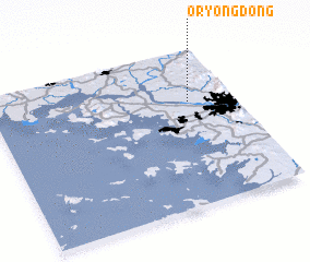 Places with similar names to Oryong-dong, Korea, South ::
// Ŏryong-dong (KP)
// Oryong-dong (KP)
// Oryong-dong (KP)
// Oryong-dong (KP)
// Oryong-dong (KP)
// Oryong-dong (KR)
// Oryong-dong (KR)
// Oryong-dong (KP)
// Oryong-dong (KP)
// Oryong-dong (KP)
Disclaimer :: Information on this page comes without warranty of any kind |
||
|
Where is Oryong-dong? Elevation and coordinates ::
Latitude (lat): 37°40'0"N Longitude (lon): 126°49'0"E
Elevation (approx.): 33m (map arrows pan, magnifying glasses zoom) |
||
|
Visiting Oryong-dong? Hotel/Accommodation ::
Book a hotel in Oryong-dong Travel Guide ::
rental cars ::
car rental offers GPS waypoint ::
download a GPX waypoint (PoI) of Oryong-dong for your GPS receiver
|
||