|
search place name
|
||
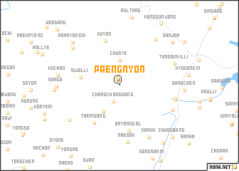
Paengnyŏn (Ulsan, Korea, South)Paengnyŏn is a town in the Ulsan region of Korea, South. An overview map of the region around Paengnyŏn is displayed below.
regional and 3d topo map of Paengnyŏn, Korea, South ::
Paengnyŏn airports ::
The nearest airport is USN - Ulsan, located 32.1 km east of Paengnyŏn.
Other airports nearby include PUS - Kimhae Gimhae Intl (38.6 km south), TAE - Taegu Daegu Ab (52.0 km north west), KPO - Pohang (63.6 km north east), YEC - Yechon Yecheon (136.4 km north west), Nearby towns ::
Ich'ŏndae-ri (1.7km north) //
Changch'ŏng-dong (2.7km south) //
Chugye (4.0km north) //
Sŏlli-dong (4.6km south west) //
Sijŏl-li (5.1km west) //
Taeri-dong (6.7km south west) //
Oryong-gol (7.1km south) //
Kuyŏn (7.2km north) //
Panggi-ri (7.4km east) //
Habang (7.5km east) //
Sinp'yŏng (7.8km south east) //
Chigok (8.6km north east) //
Tŭngŏksil-li (7.8km north east) //
Karimi (8.9km south east) //
Naech'on (8.4km north west) //
Sahoe-dong (8.4km south west) //
Nammyŏng-ni (9.0km north west) //
Sanjŏn (9.5km north east) //
Chungbang (10.5km south east) //
[all distances 'as the bird flies' and approximate] 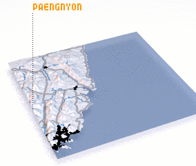 Places with similar names to Paengnyŏn, Korea, South ::
// Paengnyŏn-ni (KP)
// Pongnyŏn-ni (KP)
Disclaimer :: Information on this page comes without warranty of any kind |
||
|
Where is Paengnyŏn? Elevation and coordinates ::
Latitude (lat): 35°31'22"N Longitude (lon): 129°0'31"E
Elevation (approx.): 304m (map arrows pan, magnifying glasses zoom) |
||
|
Visiting Paengnyŏn? Hotel/Accommodation ::
Book a hotel in Paengnyŏn Travel Guide ::
rental cars ::
car rental offers GPS waypoint ::
download a GPX waypoint (PoI) of Paengnyŏn for your GPS receiver
|
||