|
search place name
|
||
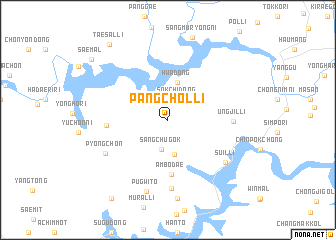
Pangch'ŏl-li (Kangwŏn, Korea, South)Pangch'ŏl-li is a town in the Kangwŏn region of Korea, South. An overview map of the region around Pangch'ŏl-li is displayed below.
regional and 3d topo map of Pangch'ŏl-li, Korea, South ::
Pangch'ŏl-li airports ::
The nearest airport is SHO - Sokch'o Sokcho, located 64.2 km east of Pangch'ŏl-li.
Other airports nearby include SSN - Seoul East Seoul Ab (95.7 km south west), KAG - Kangnung Gangneung (100.2 km east), GMP - Seoul Gimpo (110.6 km south west), OSN - Osan Ab (131.1 km south west), Nearby towns ::
Sŏkchi-dong (2.5km north) //
Sangch'ugok (3.3km south) //
Ch'ugong-ni (3.9km south) //
Hwa-dong (4.3km north) //
Ambodae (6.1km south) //
Oŭm-ni (5.5km west) //
Ungjil-li (5.8km east) //
Changjae-gol (7.7km south) //
P'yŏngch'on (6.6km south west) //
Suil-li (6.9km south east) //
Pugwit'ŏ (8.2km south) //
Nae-ch'on (8.8km south) //
T'aesal-li (9.9km north west) //
Ch'ŏngp'yŏng-gol (10.1km south west) //
Saemal (9.6km north west) //
[all distances 'as the bird flies' and approximate]  Places with similar names to Pangch'ŏl-li, Korea, South ::
// P'ungch'ol-li (KP)
// Pangch'ŏl-li (KR)
// Pangch'ol-li (KR)
// P'ungch'ŏl-li (KP)
// P'ungch'ŏl-li (KP)
// P'ungch'ŏl-li (KP)
// P'ungch'ŏl-li (KP)
// P'ungch'ŏl-li (KP)
// Pongch'ŏl-li (KP)
Disclaimer :: Information on this page comes without warranty of any kind |
||
|
Where is Pangch'ŏl-li? Elevation and coordinates ::
Latitude (lat): 38°3'45"N Longitude (lon): 127°52'24"E
Elevation (approx.): 271m (map arrows pan, magnifying glasses zoom) |
||
|
Visiting Pangch'ŏl-li? Hotel/Accommodation ::
Book a hotel in Pangch'ŏl-li Travel Guide ::
rental cars ::
car rental offers GPS waypoint ::
download a GPX waypoint (PoI) of Pangch'ŏl-li for your GPS receiver
|
||