|
search place name
|
||
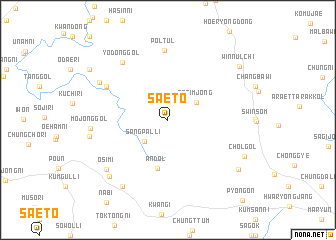
Saet'o (Ch'ungch'ŏng, Korea, South)Saet'o is a town in the Ch'ungch'ŏng region of Korea, South. An overview map of the region around Saet'o is displayed below.
regional and 3d topo map of Saet'o, Korea, South ::
Saet'o airports ::
The nearest airport is YEC - Yechon Yecheon, located 48.3 km east of Saet'o.
Other airports nearby include OSN - Osan Ab (94.4 km north west), TAE - Taegu Daegu Ab (102.9 km south east), SSN - Seoul East Seoul Ab (119.6 km north west), KUB - Kunsan Ab (129.5 km south west), Nearby towns ::
Minp'an-dong (2.2km north) //
Sangp'al-li (3.2km south west) //
Sesimjŏng (3.2km north east) //
Andol (5.5km south) //
Pŏltŭl (7.8km north) //
Namak (6.7km north west) //
Yŏdong-gol (7.6km north west) //
Mojŏng-gol (7.0km west) //
Changgap (7.4km north west) //
Osimi (7.8km south west) //
Changnae-ri (8.4km south west) //
Chonggong-ni (7.3km west) //
Kuin (8.2km south west) //
Chŏl-gol (8.0km south east) //
Tonggwanŭm (8.4km south east) //
Araennŭlt'i (8.8km north east) //
Winnŭlch'i (8.8km north east) //
Wŏnttŭl (9.0km north west) //
[all distances 'as the bird flies' and approximate] 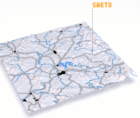 Places with similar names to Saet'o, Korea, South ::
Disclaimer :: Information on this page comes without warranty of any kind |
||
|
Where is Saet'o? Elevation and coordinates ::
Latitude (lat): 36°31'59"N Longitude (lon): 127°49'44"E
Elevation (approx.): 427m (map arrows pan, magnifying glasses zoom) |
||
|
Visiting Saet'o? Hotel/Accommodation ::
Book a hotel in Saet'o Travel Guide ::
rental cars ::
car rental offers GPS waypoint ::
download a GPX waypoint (PoI) of Saet'o for your GPS receiver
|
||