|
search place name
|
||
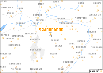
Sajŏng-dong (Kyŏnggi, Korea, South)Sajŏng-dong is a town in the Kyŏnggi region of Korea, South. An overview map of the region around Sajŏng-dong is displayed below.
regional and 3d topo map of Sajŏng-dong, Korea, South ::
Sajŏng-dong airports ::
The nearest airport is GMP - Seoul Gimpo, located 53.7 km south west of Sajŏng-dong.
Other airports nearby include SSN - Seoul East Seoul Ab (57.8 km south), OSN - Osan Ab (97.5 km south), SHO - Sokch'o Sokcho (131.5 km east), KAG - Kangnung Gangneung (162.5 km east), Nearby towns ::
Chi-dong (2.8km south east) //
Kanja-dong (2.9km east) //
Sangdaejŏn-ni (4.0km north) //
Pŏpsu-dong (3.8km north west) //
Karwŏl-li (3.9km east) //
Saemok (5.0km south east) //
Ch'omal (4.8km north west) //
Tuam-dong (5.7km north) //
Taejŏl-li (5.7km north west) //
Paegŭi-ri (6.3km north) //
Soyo-dong (5.2km south west) //
Sangch'u-dong (5.7km north east) //
Nolmi (5.7km north west) //
Pammoru (6.3km north east) //
Pongam (5.8km west) //
Ch'udong-ni (6.0km north east) //
Sŏp'yŏn-mal (5.8km west) //
Tongjŏm (7.5km south) //
Nŭt'inamubaegi (6.6km north east) //
Kŭmju-dong (6.9km north east) //
Kip'iul (6.9km south east) //
Chŏn'gok (7.8km north west) //
Tongduch'ŏn (7.6km south west) //
T'ŏkkŏ-ri (8.4km south) //
Hasimgok (7.5km south east) //
Kŭmsu-dong (8.1km north east) //
Chungi-gol (8.6km south west) //
Oga-ri (8.7km north east) //
Wŏnmoru (9.9km south east) //
[all distances 'as the bird flies' and approximate] 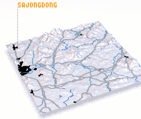 Places with similar names to Sajŏng-dong, Korea, South ::
// Sajang-dong (KP)
// Sajang-dong (KP)
// Sajŏng-dong (KP)
// Sajŏng-dong (KP)
// Sijŏng-dong (KP)
// Sŏjang-dong (KP)
// Sojang-dong (KP)
// Sŏjŏng-dong (KP)
// Sojong-dong (KP)
// Sojung-dong (KP)
Disclaimer :: Information on this page comes without warranty of any kind |
||
|
Where is Sajŏng-dong? Elevation and coordinates ::
Latitude (lat): 37°58'0"N Longitude (lon): 127°7'0"E
Elevation (approx.): 140m (map arrows pan, magnifying glasses zoom) |
||
|
Visiting Sajŏng-dong? Hotel/Accommodation ::
Book a hotel in Sajŏng-dong Travel Guide ::
rental cars ::
car rental offers GPS waypoint ::
download a GPX waypoint (PoI) of Sajŏng-dong for your GPS receiver
|
||