|
search place name
|
||
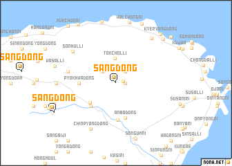
Sang-dong (Cheju, Korea, South)Sang-dong is a town in the Cheju region of Korea, South. An overview map of the region around Sang-dong is displayed below.
regional and 3d topo map of Sang-dong, Korea, South ::
Sang-dong airports ::
The nearest airport is CJU - Cheju Jeju Intl, located 26.2 km west of Sang-dong.
Other airports nearby include RSU - Yeosu (171.4 km north east), KWJ - Kwangju Gwangju (184.1 km north), Nearby towns ::
Songdang-ni (1.0km east) //
Chung-dong (1.2km east) //
Ha-dong (2.2km north east) //
Pongch'u-dong (2.6km north west) //
Tŏkch'ŏl-li (4.0km north) //
Taech'ŏn-dong (4.8km south west) //
Kamballae (5.1km south west) //
Anbo-dong (5.7km south) //
Pyŏkhwa-dong (4.9km west) //
Kuryong-dong (6.0km south) //
Ch'ŏnsŏng-dong (6.7km west) //
Sŏnin-dong (6.7km west) //
Chinp'yŏng-dong (8.2km south west) //
Sŏnhŭl-li (7.7km north west) //
Handong-ni (8.7km north east) //
P'yŏngdae-ri (9.5km north east) //
Kyeryong-dong (9.9km north east) //
Taesuha-dong (10.5km north east) //
[all distances 'as the bird flies' and approximate] 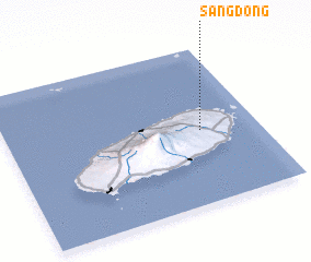 Places with similar names to Sang-dong, Korea, South ::
// Sangadaung (MM)
// Sa-ngawdung (MM)
// Sina Gahtawng (MM)
// Sungai Tinggi (MY)
// Sungai Udang (MY)
// Singatanga (BF)
// Songotongo (GT)
// Sungaitengah (ID)
// Sungaiudang (ID)
// Sangatanga (GA)
Disclaimer :: Information on this page comes without warranty of any kind |
||
|
Where is Sang-dong? Elevation and coordinates ::
Latitude (lat): 33°28'1"N Longitude (lon): 126°46'12"E
Elevation (approx.): 226m (map arrows pan, magnifying glasses zoom) |
||
|
Visiting Sang-dong? Hotel/Accommodation ::
Book a hotel in Sang-dong Travel Guide ::
rental cars ::
car rental offers GPS waypoint ::
download a GPX waypoint (PoI) of Sang-dong for your GPS receiver
|
||