|
search place name
|
||
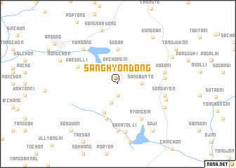
Sanghyŏn-dong (Kyŏnggi, Korea, South)Sanghyŏn-dong is a town in the Kyŏnggi region of Korea, South. An overview map of the region around Sanghyŏn-dong is displayed below.
regional and 3d topo map of Sanghyŏn-dong, Korea, South ::
Sanghyŏn-dong airports ::
The nearest airport is OSN - Osan Ab, located 33.8 km north west of Sanghyŏn-dong.
Other airports nearby include SSN - Seoul East Seoul Ab (59.4 km north), GMP - Seoul Gimpo (84.7 km north west), YEC - Yechon Yecheon (95.0 km east), KUB - Kunsan Ab (134.2 km south west), Nearby towns ::
Taemyŏng-dong (1.9km south) //
Okchŏng-ni (2.9km north) //
Sangdae-ri (3.1km south) //
Sangbunt'o (3.0km east) //
Yongdŏng-ni (4.9km south) //
Sŏgam (5.6km north) //
Yugok (5.8km south) //
Myongsim (6.3km south east) //
Kaesal-li (5.8km north west) //
Ŏkusu (7.4km south) //
Kŭmgong-ni (6.0km east) //
Hoeani (6.2km east) //
Songhyŏn (6.2km east) //
Sŏkhyŏl-li (7.7km south) //
Kŭmgang (7.1km north west) //
Changyang-ni (6.6km east) //
Chungbok (7.0km south east) //
Sangsam-dong (8.8km north) //
Kŭngnak (8.6km north east) //
Saji (8.6km south east) //
Kwanghyewŏl-li (8.1km north east) //
Sŏsuwŏn (9.5km south west) //
[all distances 'as the bird flies' and approximate] 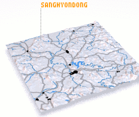 Places with similar names to Sanghyŏn-dong, Korea, South ::
// Sanghyŏn-dong (KP)
// Sanghyŏn-dong (KP)
// Sŏnghyŏn-dong (KP)
// Sŏnghyŏn-dong (KP)
// Sŏnghyŏn-dong (KP)
// Songhyŏn-dong (KP)
// Songhyŏn-dong (KP)
// Songhyŏn-dong (KP)
// Songhyŏn-dong (KP)
// Sanghyŏn-dong (KP)
Disclaimer :: Information on this page comes without warranty of any kind |
||
|
Where is Sanghyŏn-dong? Elevation and coordinates ::
Latitude (lat): 36°57'0"N Longitude (lon): 127°22'0"E
Elevation (approx.): 396m (map arrows pan, magnifying glasses zoom) |
||
|
Visiting Sanghyŏn-dong? Hotel/Accommodation ::
Book a hotel in Sanghyŏn-dong Travel Guide ::
rental cars ::
car rental offers GPS waypoint ::
download a GPX waypoint (PoI) of Sanghyŏn-dong for your GPS receiver
|
||