|
search place name
|
||
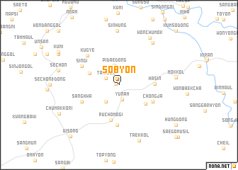
Sŏbyŏn (Kyŏngsang, Korea, South)Sŏbyŏn is a town in the Kyŏngsang region of Korea, South. An overview map of the region around Sŏbyŏn is displayed below.
regional and 3d topo map of Sŏbyŏn, Korea, South ::
Sŏbyŏn airports ::
The nearest airport is YEC - Yechon Yecheon, located 43.7 km north west of Sŏbyŏn.
Other airports nearby include TAE - Taegu Daegu Ab (59.6 km south), KPO - Pohang (76.0 km south east), USN - Ulsan (106.0 km south east), PUS - Kimhae Gimhae Intl (138.9 km south), Nearby towns ::
Sa-ch'on (0.4km north west) //
Yunam (2.3km south) //
Tari-gol (2.0km north west) //
Pidae-dong (3.2km north) //
Myŏnggo (3.1km south west) //
Songnae (4.1km north west) //
Kusŏng (4.4km south east) //
Hasin (4.5km east) //
Puch'ŏmogi (5.6km south) //
Chŏngja (5.0km south east) //
Kuam (6.3km south) //
Sanghwa (5.3km south west) //
Sin'gi (5.5km north west) //
Kugye (6.1km north west) //
Ch'umok-tong (7.9km north east) //
Sinhŭng (8.5km north) //
Wŏnch'umok (8.4km north east) //
Taek-kol (9.1km south) //
Ŭisŏng (10.2km south west) //
[all distances 'as the bird flies' and approximate] 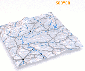 Places with similar names to Sŏbyŏn, Korea, South ::
Disclaimer :: Information on this page comes without warranty of any kind |
||
|
Where is Sŏbyŏn? Elevation and coordinates ::
Latitude (lat): 36°25'24"N Longitude (lon): 128°46'8"E
Elevation (approx.): 170m (map arrows pan, magnifying glasses zoom) |
||
|
Visiting Sŏbyŏn? Hotel/Accommodation ::
Book a hotel in Sŏbyŏn Travel Guide ::
rental cars ::
car rental offers GPS waypoint ::
download a GPX waypoint (PoI) of Sŏbyŏn for your GPS receiver
|
||