|
search place name
|
||
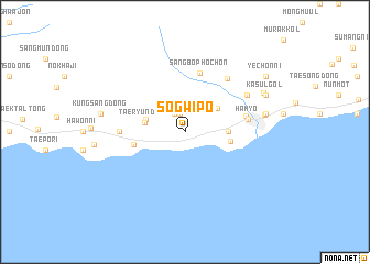
Sŏgwip'o (Cheju, Korea, South)Sŏgwip'o is a town in the Cheju region of Korea, South. An overview map of the region around Sŏgwip'o is displayed below.
regional and 3d topo map of Sŏgwip'o, Korea, South ::
Sŏgwip'o airports ::
The nearest airport is CJU - Cheju Jeju Intl, located 29.7 km north of Sŏgwip'o.
Other airports nearby include RSU - Yeosu (201.8 km north east), KWJ - Kwangju Gwangju (209.4 km north), Nearby towns ::
Sŏhong-dong (1.8km north) //
Nulpat (2.1km north west) //
T'op'yŏng-dong (3.7km north east) //
Taeryun-dong (3.5km west) //
Hogŭn-dong (3.6km west) //
Malchokpat (3.7km east) //
Pomok-tong (4.0km east) //
Pŏphwan-dong (4.6km west) //
Sangbŏphoch'ŏn (6.2km north) //
Sinhyo-dong (5.5km east) //
Hahyo (5.5km east) //
Wŏlsan-dong (5.6km west) //
Yŏngch'ŏn-dong (6.5km north east) //
Sanghyo-ri (6.5km north east) //
Chiksa-dong (6.5km north east) //
Harye-ri (7.0km east) //
Kulchŏn-dong (7.1km east) //
Kungsang-dong (7.4km west) //
Sillye-ri (7.7km north east) //
Kasŭl-gol (7.8km north east) //
Yech'ŏn-ni (8.8km north east) //
[all distances 'as the bird flies' and approximate] 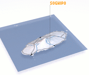 Places with similar names to Sŏgwip'o, Korea, South :: Disclaimer :: Information on this page comes without warranty of any kind |
||
|
Where is Sŏgwip'o? Elevation and coordinates ::
Latitude (lat): 33°14'59"N Longitude (lon): 126°33'36"E
Elevation (approx.): 62m (map arrows pan, magnifying glasses zoom) |
||
|
Visiting Sŏgwip'o? Hotel/Accommodation ::
Book a hotel in Sŏgwip'o Travel Guide ::
rental cars ::
car rental offers GPS waypoint ::
download a GPX waypoint (PoI) of Sŏgwip'o for your GPS receiver
|
||