|
search place name
|
||
Sŏngnam (Ch'ungch'ŏng, Korea, South)Sŏngnam is a town in the Ch'ungch'ŏng region of Korea, South. An overview map of the region around Sŏngnam is displayed below.
regional and 3d topo map of Sŏngnam, Korea, South ::

Sŏngnam airports ::
The nearest airport is OSN - Osan Ab, located 74.7 km north west of Sŏngnam.
Other airports nearby include YEC - Yechon Yecheon (77.3 km east), KUB - Kunsan Ab (105.8 km south west), SSN - Seoul East Seoul Ab (106.9 km north), TAE - Taegu Daegu Ab (126.1 km south east), Nearby towns ::
Koŭl-li (3.5km north) //
Munŭi (3.7km south) //
P'umsil (4.8km south west) //
Ch'ŏngnyong-ni (4.2km east) //
Sangsan (5.6km south) //
Hyoch'on (5.8km north) //
Myoam-ni (6.4km south east) //
Changsŏng-dong (6.7km north west) //
Ch'ŏksal-li (6.4km north west) //
Magu-ri (6.2km east) //
Taman (6.2km west) //
Ŭnhaeng-ni (6.7km north east) //
Kongsu-gol (7.1km north west) //
Miho-dong (8.1km south) //
Oech'ŏl-li (7.2km west) //
Wŏro-dong (9.3km north) //
Sangjŏng-ni (9.5km north east) //
Sint'anjin (10.8km south west) //
[all distances 'as the bird flies' and approximate] 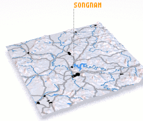 Places with similar names to Sŏngnam, Korea, South ::
// Sengnam (MM)
// Zouingonmè (BJ)
// Sanggonemi (KP)
// Sangnim (KP)
// Sangnim (KP)
// Sŏngnam (KP)
// Sŏngnam (KP)
// Songnim (KP)
// Songnim (KP)
// Saengnim (KR)
Disclaimer :: Information on this page comes without warranty of any kind |
||
|
Where is Sŏngnam? Elevation and coordinates ::
Latitude (lat): 36°32'0"N Longitude (lon): 127°30'0"E
Elevation (approx.): 90m (map arrows pan, magnifying glasses zoom) |
||
|
Visiting Sŏngnam? Hotel/Accommodation ::
Book a hotel in Sŏngnam Travel Guide ::
rental cars ::
car rental offers GPS waypoint ::
download a GPX waypoint (PoI) of Sŏngnam for your GPS receiver
|
||