|
search place name
|
||
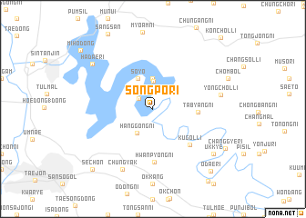
Songp'o-ri (Taejŏn, Korea, South)Songp'o-ri is a town in the Taejŏn region of Korea, South. An overview map of the region around Songp'o-ri is displayed below.
regional and 3d topo map of Songp'o-ri, Korea, South ::
Songp'o-ri airports ::
The nearest airport is YEC - Yechon Yecheon, located 76.5 km east of Songp'o-ri.
Other airports nearby include OSN - Osan Ab (89.6 km north west), KUB - Kunsan Ab (100.5 km south west), TAE - Taegu Daegu Ab (114.5 km south east), SSN - Seoul East Seoul Ab (122.4 km north), Nearby towns ::
Chuch'ol-li (1.9km north west) //
Saŭm-ni (3.4km north) //
Hanggong-ni (3.3km south west) //
Maesan (3.7km north) //
Soyŏ (4.0km north) //
Tabyang-ni (4.5km east) //
Kugŏl-li (5.8km south east) //
Hwanp'yŏng-ni (6.5km south) //
Chŭngyak (8.0km south) //
Yongch'ol-li (6.9km east) //
Ukkye (8.2km south east) //
Hadae-ri (8.2km north west) //
Odae-ri (9.5km south east) //
Sech'ŏn (9.5km south west) //
Sŏkt'al-li (10.4km south east) //
Miho-dong (10.2km north west) //
Kŏnch'ŏl-li (11.0km north east) //
[all distances 'as the bird flies' and approximate] 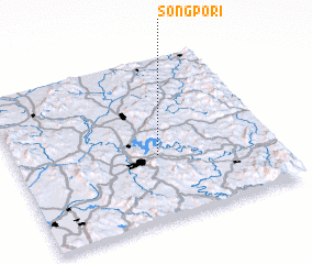 Places with similar names to Songp'o-ri, Korea, South ::
// Singapore (SG)
// Singapore (ZA)
// Singpur (BD)
// Singpur (BD)
// Sinakpérou (BJ)
// Sinékparou (BJ)
// Sonkparé (BJ)
// Singāpur (IN)
// Singpur (IN)
// Singpur (IN)
Disclaimer :: Information on this page comes without warranty of any kind |
||
|
Where is Songp'o-ri? Elevation and coordinates ::
Latitude (lat): 36°24'0"N Longitude (lon): 127°33'0"E
Elevation (approx.): 101m (map arrows pan, magnifying glasses zoom) |
||
|
Visiting Songp'o-ri? Hotel/Accommodation ::
Book a hotel in Songp'o-ri Travel Guide ::
rental cars ::
car rental offers GPS waypoint ::
download a GPX waypoint (PoI) of Songp'o-ri for your GPS receiver
|
||