|
search place name
|
||
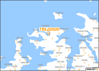
Taejung-ni (Ch'ungch'ŏng, Korea, South)Taejung-ni is a town in the Ch'ungch'ŏng region of Korea, South. An overview map of the region around Taejung-ni is displayed below.
regional and 3d topo map of Taejung-ni, Korea, South ::
Taejung-ni airports ::
The nearest airport is OSN - Osan Ab, located 57.3 km east of Taejung-ni.
Other airports nearby include GMP - Seoul Gimpo (72.6 km north east), SSN - Seoul East Seoul Ab (81.5 km north east), KUB - Kunsan Ab (121.4 km south), YEC - Yechon Yecheon (178.7 km east), Nearby towns ::
Taero-ri (1.4km south east) //
Kiŭl-li (1.8km south west) //
Hanppul-li (2.4km north east) //
Sukhoji (3.1km north west) //
Hwagong-ni (2.9km east) //
Tokkon-ni (3.8km west) //
Oji-ri (4.8km south west) //
Sanjŏn-ni (5.8km south) //
Samgilp'o (4.8km east) //
Unsal-li (5.1km east) //
Taesan (5.8km south east) //
Kujin (6.3km south east) //
Ungdo-ri (7.6km south) //
Hwansŏng-ni (8.1km south) //
T'ap-kol (8.0km south) //
Taenanji (8.2km north) //
Hoegae (8.1km south east) //
[all distances 'as the bird flies' and approximate] 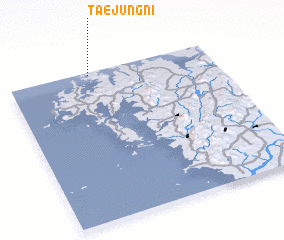 Places with similar names to Taejung-ni, Korea, South ::
// Dow Jangān (IR)
// Dijungania (IN)
// Djongouna (NE)
// Djinokouna (SN)
// Taejŏng-ni (KP)
// Taejŏng-ni (KP)
// Taejŏng-ni (KP)
// Taejŏng-ni (KP)
// Taejung-ni (KP)
// Taejung-ni (KP)
Disclaimer :: Information on this page comes without warranty of any kind |
||
|
Where is Taejung-ni? Elevation and coordinates ::
Latitude (lat): 36°59'0"N Longitude (lon): 126°24'0"E
Elevation (approx.): 13m (map arrows pan, magnifying glasses zoom) |
||
|
Visiting Taejung-ni? Hotel/Accommodation ::
Book a hotel in Taejung-ni Travel Guide ::
rental cars ::
car rental offers GPS waypoint ::
download a GPX waypoint (PoI) of Taejung-ni for your GPS receiver
|
||