|
search place name
|
||
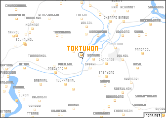
Tŏktuwŏn (Kangwŏn, Korea, South)Tŏktuwŏn is a town in the Kangwŏn region of Korea, South. An overview map of the region around Tŏktuwŏn is displayed below.
regional and 3d topo map of Tŏktuwŏn, Korea, South ::
Tŏktuwŏn airports ::
The nearest airport is SSN - Seoul East Seoul Ab, located 66.6 km south west of Tŏktuwŏn.
Other airports nearby include GMP - Seoul Gimpo (84.0 km south west), SHO - Sokch'o Sokcho (87.8 km east), OSN - Osan Ab (101.7 km south west), KAG - Kangnung Gangneung (112.8 km east), Nearby towns ::
Sorigae (1.9km east) //
Oppawi (2.4km south east) //
Myŏngwŏl-li (2.3km north west) //
Paeil-gol (3.7km south west) //
Palmi (4.8km south east) //
Ch'angnae (4.3km east) //
Chunggan-mal (5.7km north) //
Wŏn'gŭmsan (6.0km north east) //
Chŭng-ni (5.9km south east) //
Taep'yŏng (5.7km south east) //
Madang-gol (5.4km west) //
Paegyang (5.8km south west) //
Kugong-ni (6.6km south west) //
Mulkkaemal (6.6km south west) //
Tokka-dong (6.4km north west) //
Ch'angch'ol-li (7.1km south) //
Wŏl-gol (7.3km north) //
Ch'unch'ŏn (6.3km north east) //
Samp'o (7.2km south east) //
P'albat'mugi (7.0km north west) //
Oksanp'o (9.8km north east) //
[all distances 'as the bird flies' and approximate]  Places with similar names to Tŏktuwŏn, Korea, South ::
Disclaimer :: Information on this page comes without warranty of any kind |
||
|
Where is Tŏktuwŏn? Elevation and coordinates ::
Latitude (lat): 37°51'7"N Longitude (lon): 127°40'8"E
Elevation (approx.): 81m (map arrows pan, magnifying glasses zoom) |
||
|
Visiting Tŏktuwŏn? Hotel/Accommodation ::
Book a hotel in Tŏktuwŏn Travel Guide ::
rental cars ::
car rental offers GPS waypoint ::
download a GPX waypoint (PoI) of Tŏktuwŏn for your GPS receiver
|
||