|
search place name
|
||
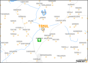
T'omul (Ch'ungch'ŏng, Korea, South)T'omul is a town in the Ch'ungch'ŏng region of Korea, South. An overview map of the region around T'omul is displayed below.
regional and 3d topo map of T'omul, Korea, South ::
T'omul airports ::
The nearest airport is OSN - Osan Ab, located 57.6 km north west of T'omul.
Other airports nearby include YEC - Yechon Yecheon (76.0 km east), SSN - Seoul East Seoul Ab (85.1 km north west), GMP - Seoul Gimpo (110.5 km north west), KUB - Kunsan Ab (123.9 km south west), Nearby towns ::
Yonggye-ri (0.3km south west) //
Naesu-ri (2.8km south east) //
Hakp'yŏng (4.0km south) //
Sin'gi-ri (3.5km south east) //
Ipyang-ni (4.0km south) //
Ŭnam-ni (5.1km north) //
P'yŏngsa (5.8km north) //
Segyo-ri (5.9km south east) //
Ŭnjae (5.8km north west) //
Changdae-ri (5.5km west) //
Pokhyŏn (5.9km west) //
Hwaam (7.4km north) //
Changt'ŏ (6.2km west) //
Yŏnsin (7.1km north east) //
Chŭngp'yŏng (7.0km north east) //
Chŭngch'ŏn-dong (7.0km north east) //
Oksan-ni (7.0km north west) //
Oksŏng-ni (7.3km north west) //
Sinp'yŏng-ni (8.6km south west) //
[all distances 'as the bird flies' and approximate]  Places with similar names to T'omul, Korea, South ::
Disclaimer :: Information on this page comes without warranty of any kind |
||
|
Where is T'omul? Elevation and coordinates ::
Latitude (lat): 36°45'0"N Longitude (lon): 127°31'0"E
Elevation (approx.): 68m (map arrows pan, magnifying glasses zoom) |
||
|
Visiting T'omul? Hotel/Accommodation ::
Book a hotel in T'omul Travel Guide ::
rental cars ::
car rental offers GPS waypoint ::
download a GPX waypoint (PoI) of T'omul for your GPS receiver
|
||