|
search place name
|
||
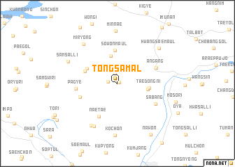
Tongsamal (Kyŏngsang, Korea, South)Tongsamal is a town in the Kyŏngsang region of Korea, South. An overview map of the region around Tongsamal is displayed below.
regional and 3d topo map of Tongsamal, Korea, South ::
Tongsamal airports ::
The nearest airport is KPO - Pohang, located 22.7 km east of Tongsamal.
Other airports nearby include USN - Ulsan (44.8 km south), TAE - Taegu Daegu Ab (46.9 km west), PUS - Kimhae Gimhae Intl (90.1 km south), YEC - Yechon Yecheon (103.8 km north west), Nearby towns ::
Turyu-ri (0.3km north east) //
Sabak-kol (1.3km west) //
Samgŏri (1.6km north) //
Sŏm-ch'on (4.4km north) //
Han-gol (4.0km east) //
Taedong-ni (4.2km east) //
Sŏwŏn-maŭl (5.3km north) //
Kanggyo-ri (4.6km north west) //
Nŏdŏ-ri (4.6km north west) //
Naet'ae (5.8km south west) //
Tŏksŏng (5.3km south west) //
P'agye (5.4km west) //
An'gang (5.6km north east) //
Sabang (5.9km south east) //
Namsa (7.5km south west) //
Chong-dong (7.6km south west) //
Miryong (7.7km north west) //
Koch'ŏn (8.4km south) //
Minnae (8.4km north) //
Samsal-li (7.3km north west) //
Hwangsae-maŭl (7.8km north east) //
Nawon (9.2km south east) //
[all distances 'as the bird flies' and approximate] 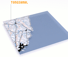 Places with similar names to Tongsamal, Korea, South ::
// Tongsaemal (KP)
Disclaimer :: Information on this page comes without warranty of any kind |
||
|
Where is Tongsamal? Elevation and coordinates ::
Latitude (lat): 35°58'10"N Longitude (lon): 129°10'12"E
Elevation (approx.): 65m (map arrows pan, magnifying glasses zoom) |
||
|
Visiting Tongsamal? Hotel/Accommodation ::
Book a hotel in Tongsamal Travel Guide ::
rental cars ::
car rental offers GPS waypoint ::
download a GPX waypoint (PoI) of Tongsamal for your GPS receiver
|
||