|
search place name
|
||
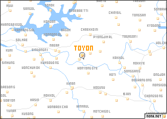
Toyŏn (Kyŏngsang, Korea, South)Toyŏn is a town in the Kyŏngsang region of Korea, South. An overview map of the region around Toyŏn is displayed below.
regional and 3d topo map of Toyŏn, Korea, South ::
Toyŏn airports ::
The nearest airport is YEC - Yechon Yecheon, located 51.9 km west of Toyŏn.
Other airports nearby include TAE - Taegu Daegu Ab (72.9 km south), KPO - Pohang (74.1 km south east), USN - Ulsan (109.7 km south), KAG - Kangnung Gangneung (137.3 km north), Nearby towns ::
Aksa (0.8km west) //
Sangbaksil (1.8km north east) //
Wŏnyonggye (3.2km south) //
Tŏkkang (3.5km north east) //
Ch'aekkŏri (5.7km north) //
Ch'ŏnjŏn-dong (4.8km north west) //
P'yŏngji-mal (5.4km north east) //
Imha (4.9km west) //
Naeap (5.5km west) //
Sagok (6.3km north west) //
Ch'ŏnji (6.6km south) //
Kiran (6.9km south) //
Kŭmso-dong (6.2km west) //
Mot'i (7.0km south east) //
Kŏnnŏn-gol (7.1km north west) //
Kak-kol (6.6km east) //
Wŏgusu (8.0km south) //
Sin'gi (8.0km south) //
Oebae (8.7km south east) //
Kŏmdan (9.5km north west) //
Monmit (10.1km north east) //
[all distances 'as the bird flies' and approximate] 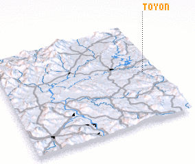 Places with similar names to Toyŏn, Korea, South ::
Disclaimer :: Information on this page comes without warranty of any kind |
||
|
Where is Toyŏn? Elevation and coordinates ::
Latitude (lat): 36°31'0"N Longitude (lon): 128°55'0"E
Elevation (approx.): 204m (map arrows pan, magnifying glasses zoom) |
||
|
Visiting Toyŏn? Hotel/Accommodation ::
Book a hotel in Toyŏn Travel Guide ::
rental cars ::
car rental offers GPS waypoint ::
download a GPX waypoint (PoI) of Toyŏn for your GPS receiver
|
||