|
search place name
|
||
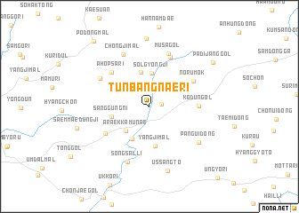
Tunbangnae-ri (Kangwŏn, Korea, South)Tunbangnae-ri is a town in the Kangwŏn region of Korea, South. An overview map of the region around Tunbangnae-ri is displayed below.
regional and 3d topo map of Tunbangnae-ri, Korea, South ::
Tunbangnae-ri airports ::
The nearest airport is KAG - Kangnung Gangneung, located 70.1 km north east of Tunbangnae-ri.
Other airports nearby include SHO - Sokch'o Sokcho (78.0 km north east), SSN - Seoul East Seoul Ab (97.2 km west), YEC - Yechon Yecheon (98.5 km south), OSN - Osan Ab (114.6 km south west), Nearby towns ::
Sijangt'ŏ (1.2km east) //
Solgyŏngji (4.2km north) //
Araekkamunae (3.9km south west) //
Chŏlbau-gol (4.4km north) //
Pail (4.4km south) //
Sanggung-ni (4.0km west) //
Yangjimal (5.0km south) //
Kodŭn-gol (4.9km east) //
Norumok (5.4km north east) //
Ahopsa-ri (5.7km north west) //
Chajakchŏng (5.5km south west) //
Chŏngmun'gŏri (6.5km north) //
Musa-gol (6.9km north) //
Tasim-ni (6.0km north west) //
Chongji-mal (7.1km north) //
Sŏngsal-li (7.3km south) //
Pangŭi-dong (6.6km south east) //
Ussangt'ŏ (8.3km south) //
Tanggŏri (8.6km north) //
Padijang-gol (8.4km north east) //
Pŏdŏng-mal (9.9km north west) //
[all distances 'as the bird flies' and approximate] 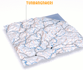 Places with similar names to Tunbangnae-ri, Korea, South :: Disclaimer :: Information on this page comes without warranty of any kind |
||
|
Where is Tunbangnae-ri? Elevation and coordinates ::
Latitude (lat): 37°30'41"N Longitude (lon): 128°12'35"E
Elevation (approx.): 504m (map arrows pan, magnifying glasses zoom) |
||
|
Visiting Tunbangnae-ri? Hotel/Accommodation ::
Book a hotel in Tunbangnae-ri Travel Guide ::
rental cars ::
car rental offers GPS waypoint ::
download a GPX waypoint (PoI) of Tunbangnae-ri for your GPS receiver
|
||