|
search place name
|
||
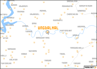
Ŭngdal-mal (Kangwŏn, Korea, South)Ŭngdal-mal is a town in the Kangwŏn region of Korea, South. An overview map of the region around Ŭngdal-mal is displayed below.
regional and 3d topo map of Ŭngdal-mal, Korea, South ::
Ŭngdal-mal airports ::
The nearest airport is SSN - Seoul East Seoul Ab, located 55.2 km south west of Ŭngdal-mal.
Other airports nearby include GMP - Seoul Gimpo (78.4 km west), OSN - Osan Ab (86.1 km south west), SHO - Sokch'o Sokcho (96.9 km north east), KAG - Kangnung Gangneung (113.0 km east), Nearby towns ::
Mangdani (2.4km north east) //
Sanggwiryang (2.9km south west) //
Hagwiryang (3.7km south) //
T'ŏil (5.1km south) //
Torung-gol (4.5km east) //
Kuŭn-dong (5.3km north east) //
Chŏm-gol (5.9km south) //
Orau (5.3km north west) //
Chungbangdae (5.3km south west) //
Punji (6.8km south) //
Kuryongbat (5.6km east) //
Toraso (5.8km west) //
Tanwŏl-li (7.5km south) //
Changgŏ-ri (7.1km north east) //
Chŏnŭi-gol (7.2km north west) //
Pŏnmal (8.2km north) //
Kajae-gol (7.9km north west) //
Win-mal (7.2km west) //
Panŭi-dong (8.6km north east) //
Such'ŏng (8.8km south west) //
T'ŏ-gol (9.7km south east) //
Kundŭl (9.9km north east) //
[all distances 'as the bird flies' and approximate]  Places with similar names to Ŭngdal-mal, Korea, South ::
// Ŭngdal-mal (KR)
// Ŭngdal-mal (KR)
Disclaimer :: Information on this page comes without warranty of any kind |
||
|
Where is Ŭngdal-mal? Elevation and coordinates ::
Latitude (lat): 37°40'39"N Longitude (lon): 127°39'58"E
Elevation (approx.): 108m (map arrows pan, magnifying glasses zoom) |
||
|
Visiting Ŭngdal-mal? Hotel/Accommodation ::
Book a hotel in Ŭngdal-mal Travel Guide ::
rental cars ::
car rental offers GPS waypoint ::
download a GPX waypoint (PoI) of Ŭngdal-mal for your GPS receiver
|
||