|
search place name
|
||
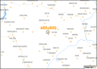
Wanjang (Kyŏngsang, Korea, South)Wanjang is a town in the Kyŏngsang region of Korea, South. An overview map of the region around Wanjang is displayed below.
regional and 3d topo map of Wanjang, Korea, South ::
Wanjang airports ::
The nearest airport is YEC - Yechon Yecheon, located 33.1 km east of Wanjang.
Other airports nearby include OSN - Osan Ab (97.2 km north west), TAE - Taegu Daegu Ab (105.4 km south east), SSN - Seoul East Seoul Ab (115.7 km north west), GMP - Seoul Gimpo (144.8 km north west), Nearby towns ::
Onnamu-gol (1.2km north west) //
Tot'ae (2.0km east) //
Hongmunjŏng (3.5km north east) //
Obongjŏng (4.6km north) //
Komujae (5.1km south) //
Sanggwanp'yŏng (5.1km west) //
Miro-ri (5.5km east) //
Malbawi (6.9km south) //
Saet'ŏ (6.8km south) //
Ŭnt'ŏ (7.1km north) //
Hagung (7.0km south west) //
Tomak (7.7km north east) //
An-mal (7.4km north east) //
Nongam (8.4km south) //
Han'gok (7.0km east) //
Kaŭn (7.3km east) //
Tot'ai (7.4km east) //
Kaksŏ (9.6km north east) //
[all distances 'as the bird flies' and approximate] 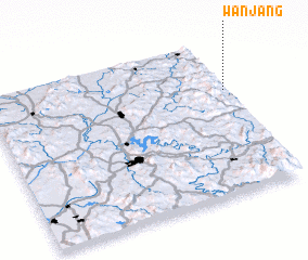 Places with similar names to Wanjang, Korea, South ::
Disclaimer :: Information on this page comes without warranty of any kind |
||
|
Where is Wanjang? Elevation and coordinates ::
Latitude (lat): 36°40'26"N Longitude (lon): 127°59'20"E
Elevation (approx.): 209m (map arrows pan, magnifying glasses zoom) |
||
|
Visiting Wanjang? Hotel/Accommodation ::
Book a hotel in Wanjang Travel Guide ::
rental cars ::
car rental offers GPS waypoint ::
download a GPX waypoint (PoI) of Wanjang for your GPS receiver
|
||