|
search place name
|
||
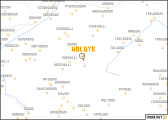
Wŏlgye (Korea, South)Wŏlgye is a town in Korea, South. An overview map of the region around Wŏlgye is displayed below.
regional and 3d topo map of Wŏlgye, Korea, South ::
Wŏlgye airports ::
The nearest airport is RSU - Yeosu, located 55.8 km south of Wŏlgye.
Other airports nearby include KWJ - Kwangju Gwangju (65.5 km west), KUB - Kunsan Ab (100.9 km north west), TAE - Taegu Daegu Ab (123.3 km north east), PUS - Kimhae Gimhae Intl (133.5 km east), Nearby towns ::
Sangwi (0.0km north) //
Chwasa-ri (1.2km south) //
Naesal-li (2.7km west) //
Surak (3.3km north west) //
Wŏnch'ol-li (4.4km south west) //
Koch'on (5.8km north) //
Yanghojŏng (6.3km north west) //
Chuch'ol-li (7.1km north) //
Ungch'i (6.6km north west) //
Changal-li (7.0km north west) //
Ondang-ni (7.1km south west) //
Talgung (6.3km east) //
Ip'yŏng-ni (8.1km south west) //
Paech'on (8.2km south west) //
Tŏktong-ni (8.1km north east) //
Sinji-ri (9.2km south west) //
Chukchŏng-ni (10.0km south west) //
[all distances 'as the bird flies' and approximate] 
Disclaimer :: Information on this page comes without warranty of any kind |
||
|
Where is Wŏlgye? Elevation and coordinates ::
Latitude (lat): 35°20'0"N Longitude (lon): 127°29'0"E
Elevation (approx.): 327m (map arrows pan, magnifying glasses zoom) |
||
|
Visiting Wŏlgye? Hotel/Accommodation ::
Book a hotel in Wŏlgye Travel Guide ::
rental cars ::
car rental offers GPS waypoint ::
download a GPX waypoint (PoI) of Wŏlgye for your GPS receiver
|
||