|
search place name
|
||
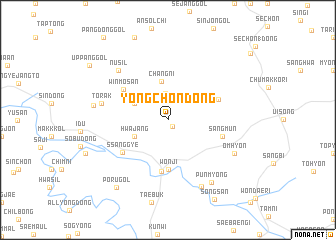
Yongch'ŏn-dong (Kyŏngsang, Korea, South)Yongch'ŏn-dong is a town in the Kyŏngsang region of Korea, South. An overview map of the region around Yongch'ŏn-dong is displayed below.
regional and 3d topo map of Yongch'ŏn-dong, Korea, South ::
Yongch'ŏn-dong airports ::
The nearest airport is YEC - Yechon Yecheon, located 37.4 km north west of Yongch'ŏn-dong.
Other airports nearby include TAE - Taegu Daegu Ab (51.0 km south), KPO - Pohang (85.4 km south east), USN - Ulsan (108.9 km south east), PUS - Kimhae Gimhae Intl (133.8 km south), Nearby towns ::
Chimigi (0.8km south east) //
Sijang (3.0km north) //
Chinae (3.5km north west) //
Hwajang (3.5km south west) //
Ch'ang-ni (4.4km north) //
Towŏn (5.6km south) //
Wŏnji (5.6km south) //
Toriwŏn (5.7km south) //
Winmosan (5.3km north west) //
Kwangbawi (5.1km north east) //
Ssanggye (5.5km south west) //
Sangmun (5.2km east) //
Torak (6.3km west) //
Nusil (7.1km north west) //
Ŏmhyŏn (7.0km south east) //
Tŏgŭn (8.0km south) //
Cho-dong (6.9km west) //
Punmyŏng (8.0km south east) //
Poru-gol (8.8km south west) //
Songsan (9.8km south east) //
Uppang-gol (9.3km north west) //
[all distances 'as the bird flies' and approximate] 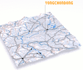 Places with similar names to Yongch'ŏn-dong, Korea, South ::
// Hyangch'ŏn-dong (KP)
// Yŏngch'ŏn-dong (KP)
// Yongch'ŏn-dong (KP)
// Yongch'on-dong (KP)
// Yŏngch'ŏn-dong (KR)
// Yŏngch'on-dong (KR)
// Yongch'ŏn-dong (KR)
// Yŏngch'un-dong (KR)
// Yongch'ŏn-dong (KP)
// Yangch'on-dong (KP)
Disclaimer :: Information on this page comes without warranty of any kind |
||
|
Where is Yongch'ŏn-dong? Elevation and coordinates ::
Latitude (lat): 36°21'0"N Longitude (lon): 128°35'0"E
Elevation (approx.): 70m (map arrows pan, magnifying glasses zoom) |
||
|
Visiting Yongch'ŏn-dong? Hotel/Accommodation ::
Book a hotel in Yongch'ŏn-dong Travel Guide ::
rental cars ::
car rental offers GPS waypoint ::
download a GPX waypoint (PoI) of Yongch'ŏn-dong for your GPS receiver
|
||