|
search place name
|
||
Yuksal-li (Chŏlla, Korea, South)Yuksal-li is a town in the Chŏlla region of Korea, South. An overview map of the region around Yuksal-li is displayed below.
regional and 3d topo map of Yuksal-li, Korea, South ::

Yuksal-li airports ::
The nearest airport is RSU - Yeosu, located 67.6 km north east of Yuksal-li.
Other airports nearby include KWJ - Kwangju Gwangju (79.3 km north), CJU - Cheju Jeju Intl (115.9 km south west), KUB - Kunsan Ab (167.1 km north), PUS - Kimhae Gimhae Intl (190.2 km north east), Nearby towns ::
Samsan-ni (1.4km south west) //
Ch'au-ri (1.5km south east) //
Sinhŭng (2.5km south west) //
Sep'o (2.9km south) //
Kahang-ni (2.5km north west) //
Udu (3.7km east) //
Sinyang (4.8km north east) //
Sinjŏn-ni (5.2km east) //
Ŏjŏl-li (5.2km east) //
Sinch'ol-li (5.8km north east) //
Yŏnso (5.6km east) //
Ch'ungdo-ri (7.3km south) //
Ongnyong (6.2km east) //
Taehŭng-ni (6.6km east) //
Kŭmjin (7.5km north east) //
Ch'ŏkch'i (8.8km south) //
Changjŏng-ni (9.4km south west) //
Sorong-ni (10.6km north east) //
[all distances 'as the bird flies' and approximate] 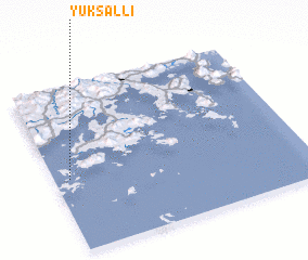 Places with similar names to Yuksal-li, Korea, South ::
// Yuksila (RU)
// Yağcılı (TR)
// Yokuşlu (TR)
// Yokuşlu (TR)
// Yüksel (TR)
// Yaxil (MX)
// Yaksal-li (KP)
// Yakay-Sola (RU)
// Hyŏksil-li (KP)
// Yokassala (CM)
Disclaimer :: Information on this page comes without warranty of any kind |
||
|
Where is Yuksal-li? Elevation and coordinates ::
Latitude (lat): 34°26'34"N Longitude (lon): 127°3'38"E
Elevation (approx.): 41m (map arrows pan, magnifying glasses zoom) |
||
|
Visiting Yuksal-li? Hotel/Accommodation ::
Book a hotel in Yuksal-li Travel Guide ::
rental cars ::
car rental offers GPS waypoint ::
download a GPX waypoint (PoI) of Yuksal-li for your GPS receiver
|
||