|
search place name
|
||
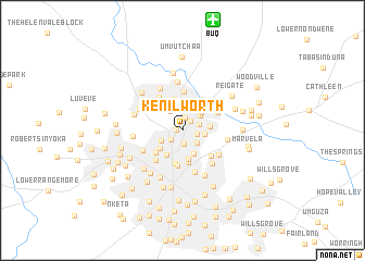
Kenilworth (Matabeleland North, Zimbabwe)Kenilworth is a town in the Matabeleland North region of Zimbabwe. An overview map of the region around Kenilworth is displayed below.
regional and 3d topo map of Kenilworth, Zimbabwe ::
Kenilworth airports ::
The nearest airport is BUQ - Bulawayo J M Nkomo Intl, located 11.7 km north of Kenilworth.
Other airports nearby include GWE - Gwert Gweru Thornhill (153.3 km north east), FRW - Francistown (163.6 km south west), PKW - Selebi-phikwe Selebi Phikwe (228.8 km south), WKM - Hwange National Park (233.1 km north west), Nearby towns ::
Rowena (0.6km west) //
Sauers Town (1.2km north east) //
Sauers Town West (1.4km north) //
North End (1.4km south) //
Greenspan (1.5km south west) //
Tegela (1.4km east) //
West Queens Park (1.7km east) //
Sunnyside (1.9km south east) //
Lobenvale (2.3km north) //
Romney Park (2.2km east) //
Highmount (2.3km north west) //
Newmansford (2.2km north east) //
Barbour Fields (2.3km south west) //
Northgate (2.5km north east) //
Paddonhurst (2.6km south east) //
East Queens Park (2.7km east) //
Mzilikazi (2.8km south west) //
Hundred Acre Lots (2.9km north) //
Makokoba (2.9km south west) //
Parkview (3.0km south) //
North Lynne (3.0km north) //
Kingsdale (3.0km north east) //
Harrisville (3.3km north) //
Fagadola (3.3km north east) //
Hume Park (3.4km south) //
The Jungle (3.4km north west) //
Bulawayo (3.5km south) //
Nguboyenia (3.5km south west) //
City (3.7km south) //
[all distances 'as the bird flies' and approximate]  Places with similar names to Kenilworth, Zimbabwe ::
// Kenilworth (US)
// Kennelworth (US)
// Kenilworth (US)
// Kenilworth (ZA)
// Kenilworth (ZA)
// Kenilworth (ZA)
// Kenilworth (US)
// Kenilworth (US)
// Kenilworth (US)
// Kenilworth (US)
Disclaimer :: Information on this page comes without warranty of any kind |
||
|
Where is Kenilworth? Elevation and coordinates ::
Latitude (lat): 20°7'10"S Longitude (lon): 28°35'22"E
Elevation (approx.): 1320m (map arrows pan, magnifying glasses zoom) |
||
|
Visiting Kenilworth? Hotel/Accommodation ::
Book a hotel in Kenilworth Travel Guide ::
Buy a travel guide for Zimbabwe rental cars ::
car rental offers GPS waypoint ::
download a GPX waypoint (PoI) of Kenilworth for your GPS receiver
|
||