|
search place name
|
||
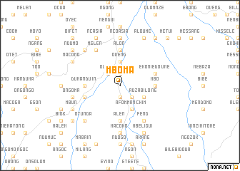
Mboma (Equatorial Guinea)Mboma is a town in Equatorial Guinea. An overview map of the region around Mboma is displayed below.
regional and 3d topo map of Mboma, Equatorial Guinea ::
Mboma airports ::
The nearest airport is BMM - Bitam, located 20.7 km east of Mboma.
Other airports nearby include OYE - Oyem (60.1 km south east), BSG - Bata (168.6 km west), YAO - Yaounde Ville (202.5 km north), MKU - Makokou (236.6 km south east), Nearby towns ::
Bison (1.9km north) //
Dalama (1.9km south) //
Abebaiñ (2.6km south east) //
Bisong (2.6km south east) //
Oveng (2.6km north west) //
Adyap (3.7km north) //
Oveng (3.7km north) //
Adzabilone (4.1km south east) //
Afommanchim (4.1km south east) //
Asoc (4.1km south east) //
Mbo (5.6km east) //
Alon (5.6km north) //
Alen (5.6km south) //
Dumanduin (5.6km west) //
Ekoniédoumé (5.9km east) //
Esong (5.9km west) //
Bitet (5.9km west) //
Feng (6.7km south east) //
Melen (6.7km north west) //
Ncoasia (7.4km north) //
Asem (7.4km north) //
Ecoo (7.4km north) //
Ecuon (7.4km north) //
Macomo (7.4km south) //
Ongoma (7.6km west) //
Bifet (7.9km north west) //
Otunga (7.9km south west) //
Aloumé (8.3km north east) //
Ncasia (8.3km north west) //
[all distances 'as the bird flies' and approximate]  Places with similar names to Mboma, Equatorial Guinea ::
Disclaimer :: Information on this page comes without warranty of any kind |
||
|
Where is Mboma? Elevation and coordinates ::
Latitude (lat): 2°1'0"N Longitude (lon): 11°19'0"E
Elevation (approx.): 593m (map arrows pan, magnifying glasses zoom) |
||
|
Visiting Mboma? Hotel/Accommodation ::
Book a hotel in Mboma Travel Guide ::
rental cars ::
car rental offers GPS waypoint ::
download a GPX waypoint (PoI) of Mboma for your GPS receiver
|
||