|
search place name
|
||
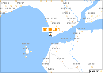
Ñamelen (Equatorial Guinea)Ñamelen is a town in Equatorial Guinea. An overview map of the region around Ñamelen is displayed below.
regional and 3d topo map of Ñamelen, Equatorial Guinea ::
Ñamelen airports ::
The nearest airport is LBV - Libreville Leon M Ba, located 66.3 km south of Ñamelen.
Other airports nearby include BSG - Bata (99.6 km north), LBQ - Lambarene (205.8 km south), POG - Port Gentil (213.9 km south west), OYE - Oyem (229.4 km east), Nearby towns ::
Punta Yeke (1.9km north) //
Evor (1.9km north) //
Bogofala (4.1km south east) //
Asamboa (4.1km north east) //
Endembe (4.1km north east) //
Ngüelensoc (5.6km north) //
Efule (5.9km north) //
Regnault (5.9km east) //
Cocobeach (5.9km south) //
Mangala (5.9km south) //
Aconekie (8.3km north east) //
Bidue (9.3km south west) //
Boboba (9.3km south west) //
Ayanesala (9.3km north east) //
Acoga (9.3km north east) //
Victoria (9.3km north east) //
Abennam (9.3km north east) //
[all distances 'as the bird flies' and approximate] 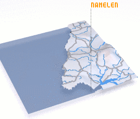 Places with similar names to Ñamelen, Equatorial Guinea ::
Disclaimer :: Information on this page comes without warranty of any kind |
||
|
Where is Ñamelen? Elevation and coordinates ::
Latitude (lat): 1°2'0"N Longitude (lon): 9°35'0"E
Elevation (approx.): -32768m (map arrows pan, magnifying glasses zoom) |
||
|
Visiting Ñamelen? Hotel/Accommodation ::
Book a hotel in Ñamelen Travel Guide ::
rental cars ::
car rental offers GPS waypoint ::
download a GPX waypoint (PoI) of Ñamelen for your GPS receiver
|
||