|
search place name
|
||
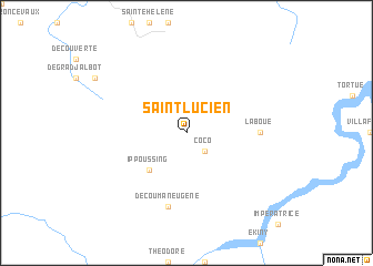
Saint-Lucien (Guyane, French Guiana)Saint-Lucien is a town in the Guyane region of French Guiana. An overview map of the region around Saint-Lucien is displayed below.
regional and 3d topo map of Saint-Lucien, French Guiana ::
Saint-Lucien airports ::
The nearest airport is CAY - Cayenne Rochambeau, located 76.5 km north of Saint-Lucien.
Nearby towns ::
Coco (2.6km south east) //
Ippoussing (5.2km south west) //
La Boue (7.4km east) //
Découman Eugène (7.6km south) //
Couy (7.6km south) //
[all distances 'as the bird flies' and approximate] 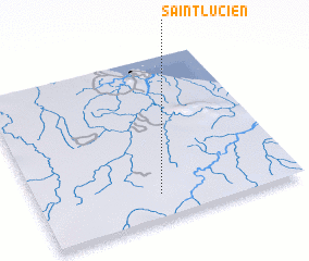 Places with similar names to Saint-Lucien, French Guiana ::
// Saint-Lézin (FR)
// Saint-Lucien (FR)
// Santa Lecina (ES)
// Saint-Lucien (FR)
// Sandulizeni (MW)
Disclaimer :: Information on this page comes without warranty of any kind |
||
|
Where is Saint-Lucien? Elevation and coordinates ::
Latitude (lat): 4°9'0"N Longitude (lon): 52°32'0"W
Elevation (approx.): 73m (map arrows pan, magnifying glasses zoom) |
||
|
Visiting Saint-Lucien? Hotel/Accommodation ::
Book a hotel in Saint-Lucien Travel Guide ::
rental cars ::
car rental offers GPS waypoint ::
download a GPX waypoint (PoI) of Saint-Lucien for your GPS receiver
|
||