|
search place name
|
||
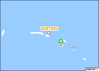
Avatoru (Polynésie Française, French Polynesia)Avatoru is a town in the Polynésie Française region of French Polynesia. An overview map of the region around Avatoru is displayed below.
regional and 3d topo map of Avatoru, French Polynesia ::
Avatoru airports ::
The nearest airport is RGI - Rangiroa, located 4.8 km south east of Avatoru.
Other airports nearby include TIH - Tikehau (60.7 km west), MVT - Mataiva (109.7 km west), KKR - Kaukura Atoll Kaukura (119.1 km south east), AXR - Arutua (121.6 km east), Nearby towns ::
[all distances 'as the bird flies' and approximate]  Places with similar names to Avatoru, French Polynesia ::
Disclaimer :: Information on this page comes without warranty of any kind |
||
|
Where is Avatoru? Elevation and coordinates ::
Latitude (lat): 14°56'0"S Longitude (lon): 147°42'0"W
Elevation (approx.): -32768m (map arrows pan, magnifying glasses zoom) |
||
|
Visiting Avatoru? Hotel/Accommodation ::
Book a hotel in Avatoru Travel Guide ::
rental cars ::
car rental offers GPS waypoint ::
download a GPX waypoint (PoI) of Avatoru for your GPS receiver
|
||