|
search place name
|
||
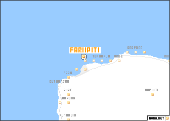
Fariipiti (Polynésie Française, French Polynesia)Fariipiti is a town in the Polynésie Française region of French Polynesia. An overview map of the region around Fariipiti is displayed below.
regional and 3d topo map of Fariipiti, French Polynesia ::
Fariipiti airports ::
The nearest airport is MOZ - Moorea, located 20.9 km west of Fariipiti.
Other airports nearby include HUH - Huahine Island Huahine (180.0 km north west), RFP - Raiatea Island Raiatea (220.4 km north west), Nearby towns ::
Patutoa (NaNkm north) //
Pahonu (NaNkm north) //
Sainte Amélie (1.9km south) //
Tipaerui (1.9km south) //
Papeete (1.9km south) //
Taunoa (1.8km east) //
Te Auae (2.6km south west) //
Arahiri (3.5km east) //
Hamuta (3.5km east) //
Pirae (3.5km east) //
Te Rua Pua (3.5km east) //
Faaa (5.1km south west) //
Papawa (5.3km east) //
Pipine (5.3km east) //
Arue (7.1km east) //
Outu Maoro (7.7km south west) //
Avae (8.2km south west) //
[all distances 'as the bird flies' and approximate] 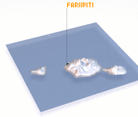 Places with similar names to Fariipiti, French Polynesia ::
Disclaimer :: Information on this page comes without warranty of any kind |
||
|
Where is Fariipiti? Elevation and coordinates ::
Latitude (lat): 17°31'0"S Longitude (lon): 149°34'0"W
Elevation (approx.): -32768m (map arrows pan, magnifying glasses zoom) |
||
|
Visiting Fariipiti? Hotel/Accommodation ::
Book a hotel in Fariipiti Travel Guide ::
rental cars ::
car rental offers GPS waypoint ::
download a GPX waypoint (PoI) of Fariipiti for your GPS receiver
|
||