|
search place name
|
||
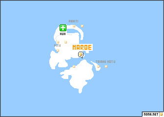
Maroe (Polynésie Française, French Polynesia)Maroe is a town in the Polynésie Française region of French Polynesia. An overview map of the region around Maroe is displayed below.
regional and 3d topo map of Maroe, French Polynesia ::
Maroe airports ::
The nearest airport is HUH - Huahine Island Huahine, located 8.1 km north west of Maroe.
Other airports nearby include RFP - Raiatea Island Raiatea (51.5 km west), BOB - Bora Bora (88.7 km west), MAU - Maupiti (139.2 km west), MOZ - Moorea (153.6 km south east), Nearby towns ::
Teapaa (2.6km south west) //
Haapu (2.6km south west) //
Fareeru (4.0km south east) //
Farehau (5.1km north west) //
Fitii (5.6km west) //
Motu Taiahu (5.6km east) //
Tahateao (6.5km north west) //
Puahua (6.6km north west) //
Fare (6.6km north west) //
Maheva (7.4km north) //
Pahiti (7.6km north) //
[all distances 'as the bird flies' and approximate] 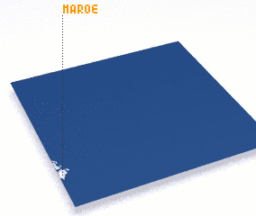 Places with similar names to Maroe, French Polynesia ::
Disclaimer :: Information on this page comes without warranty of any kind |
||
|
Where is Maroe? Elevation and coordinates ::
Latitude (lat): 16°45'0"S Longitude (lon): 150°59'0"W
Elevation (approx.): -32768m (map arrows pan, magnifying glasses zoom) |
||
|
Visiting Maroe? Hotel/Accommodation ::
Book a hotel in Maroe Travel Guide ::
rental cars ::
car rental offers GPS waypoint ::
download a GPX waypoint (PoI) of Maroe for your GPS receiver
|
||