|
search place name
|
||
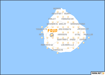
Faup (Guadeloupe, Guadeloupe)Faup is a town in the Guadeloupe region of Guadeloupe. An overview map of the region around Faup is displayed below.
regional and 3d topo map of Faup, Guadeloupe ::
Faup airports ::
The nearest airport is DOM - Dominica Melville Hall, located 40.9 km south of Faup.
Other airports nearby include PTP - Pointe-a-pitre Le Raizet (45.9 km north west), DCF - Canefield (64.9 km south), ANU - Antigua V C Bird Intl (144.9 km north), FDF - Fort-de-france Le Lamentin (150.1 km south), Nearby towns ::
Gay (0.0km north) //
Saint-Charles (1.9km north) //
Siblet (1.9km north) //
Moringlane (1.8km east) //
Bonnet (1.8km east) //
Mon Repos (1.8km east) //
Maréchal (1.8km west) //
Grande Anse (1.8km west) //
Portel (2.6km south east) //
Port Louis (2.6km south east) //
Roussel (2.6km south west) //
Ballet (2.6km south west) //
Durocher (3.6km east) //
Vanniers (3.6km east) //
Courbaril (3.7km north) //
Bagatelle (3.7km north) //
Saint-Louis (3.7km north) //
Littoral (3.7km north) //
Desmarais (3.7km north) //
Retz (3.6km west) //
Murat (3.7km south) //
Beaurenom (3.7km south) //
Bonneval (3.7km south) //
Grand-Bourg (3.7km south) //
Lami (3.7km south) //
Vallon Vrimouth (4.0km north east) //
Trois-Îlets (4.0km north west) //
Saint-Marc (4.0km south east) //
Pirogue (4.0km south east) //
[all distances 'as the bird flies' and approximate]  Places with similar names to Faup, Guadeloupe ::
Disclaimer :: Information on this page comes without warranty of any kind |
||
|
Where is Faup? Elevation and coordinates ::
Latitude (lat): 15°55'0"N Longitude (lon): 61°18'0"W
Elevation (approx.): 69m (map arrows pan, magnifying glasses zoom) |
||
|
Visiting Faup? Hotel/Accommodation ::
Book a hotel in Faup Travel Guide ::
Buy a travel guide for Guadeloupe rental cars ::
car rental offers GPS waypoint ::
download a GPX waypoint (PoI) of Faup for your GPS receiver
|
||