|
search place name
|
||
Saint-Charles (Guadeloupe, Guadeloupe)Saint-Charles is a town in the Guadeloupe region of Guadeloupe. An overview map of the region around Saint-Charles is displayed below.
regional and 3d topo map of Saint-Charles, Guadeloupe ::

Saint-Charles airports ::
The nearest airport is PTP - Pointe-a-pitre Le Raizet, located 36.0 km north east of Saint-Charles.
Other airports nearby include DOM - Dominica Melville Hall (64.6 km south east), DCF - Canefield (78.8 km south east), ANU - Antigua V C Bird Intl (128.0 km north), FDF - Fort-de-france Le Lamentin (171.3 km south east), Nearby towns ::
Blanchet (0.0km north) //
Bisdary (1.8km west) //
Roussel (1.9km north) //
Gourbeyre (1.8km east) //
Champfleury (1.8km east) //
Basse-Terre (2.6km north west) //
Dôlé (3.6km east) //
Valeau (3.7km north) //
Grande Anse (4.0km south east) //
Dubois (4.1km south west) //
Vieux-Fort (4.1km south east) //
Charneau (4.0km north east) //
Saint-Claude (4.1km north east) //
Gallard (4.1km north east) //
Baillif (5.1km north west) //
Camp Jacob (5.6km north) //
Parnasse (5.6km north) //
Boyer (5.3km east) //
Bord de Mer (5.7km east) //
Valeau (5.8km north) //
Saint-Val-Labique (5.7km west) //
Matouba (5.8km north) //
Madeleine (6.6km north west) //
Planel (7.4km north) //
Saint-Gilles (7.1km east) //
Trois-Rivières (7.4km east) //
Petit Carbet (7.4km east) //
Latapie (7.4km east) //
Blondin (7.7km north west) //
[all distances 'as the bird flies' and approximate] 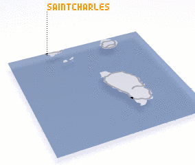 Places with similar names to Saint-Charles, Guadeloupe ::
// Saint Charles (US)
// Saint Charles (US)
// Saint Charles (US)
// Saint Charles (US)
// Saint Charles (US)
// Saint Charles (US)
// Saint Charles (US)
// Saint Charles (US)
// Saint Charles (US)
// Saint Charles (US)
Disclaimer :: Information on this page comes without warranty of any kind |
||
|
Where is Saint-Charles? Elevation and coordinates ::
Latitude (lat): 15°59'0"N Longitude (lon): 61°42'0"W
Elevation (approx.): 264m (map arrows pan, magnifying glasses zoom) |
||
|
Visiting Saint-Charles? Hotel/Accommodation ::
Book a hotel in Saint-Charles Travel Guide ::
Buy a travel guide for Guadeloupe rental cars ::
car rental offers GPS waypoint ::
download a GPX waypoint (PoI) of Saint-Charles for your GPS receiver
|
||