|
search place name
|
||
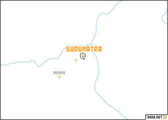
Surumatra (Upper Takutu-Upper Essequibo, Guyana)Surumatra is a town in the Upper Takutu-Upper Essequibo region of Guyana. An overview map of the region around Surumatra is displayed below.
regional and 3d topo map of Surumatra, Guyana ::
Surumatra airports ::
The nearest airport is LTM - Lethem, located 119.0 km south west of Surumatra.
Other airports nearby include BVB - Boa Vista (232.1 km south west), Nearby towns ::
Surama Village (1.8km west) //
Peropo (6.7km south west) //
[all distances 'as the bird flies' and approximate] 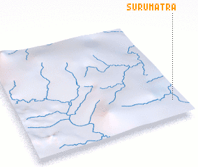 Places with similar names to Surumatra, Guyana ::
// Sierra Madre (US)
// Cerro Madera (PA)
// Sar Midir (ET)
// Sar Midir (ET)
// Sir Muttra (IN)
// Zérma Daré (NE)
// Zurumútaro (MX)
Disclaimer :: Information on this page comes without warranty of any kind |
||
|
Where is Surumatra? Elevation and coordinates ::
Latitude (lat): 4°10'0"N Longitude (lon): 59°4'0"W
Elevation (approx.): 86m (map arrows pan, magnifying glasses zoom) |
||
|
Visiting Surumatra? Hotel/Accommodation ::
Book a hotel in Surumatra Travel Guide ::
Buy a travel guide for Guyana rental cars ::
car rental offers GPS waypoint ::
download a GPX waypoint (PoI) of Surumatra for your GPS receiver
|
||