|
search place name
|
||
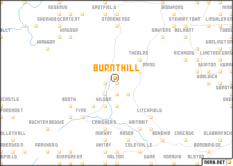
Burnt Hill (Trelawny, Jamaica)Burnt Hill is a town in the Trelawny region of Jamaica. An overview map of the region around Burnt Hill is displayed below.
regional and 3d topo map of Burnt Hill, Jamaica ::
Burnt Hill airports ::
The nearest airport is MBJ - Montego Bay Sangster Intl, located 44.5 km north west of Burnt Hill.
Other airports nearby include OCJ - Ocho Rios Boscobel (62.5 km east), KTP - Kingston Tinson Pen (84.2 km south east), KIN - Kingston Norman Manley Intl (90.2 km south east), POT - Port Antonio Ken Jones (108.0 km east), Nearby towns ::
Saint Vincent (0.0km north) //
Albert Town (1.9km south) //
Spring Garden (1.8km west) //
Stettin (2.6km south east) //
Rock Spring (2.6km south west) //
Bristol (2.6km south east) //
Goat Island (3.7km south) //
Ulster Spring (4.0km north east) //
Wilson (4.1km south west) //
The Alps (5.1km north east) //
Warsop (5.1km south west) //
Craig Head (7.6km south) //
Litchfield (7.7km south east) //
Tyre (7.7km south west) //
Wait a Bit (8.2km south east) //
Booth (8.0km south west) //
Lowe River (9.1km south east) //
Troy (9.0km south west) //
Windsor (10.2km north west) //
Sawyers (10.2km north east) //
[all distances 'as the bird flies' and approximate] 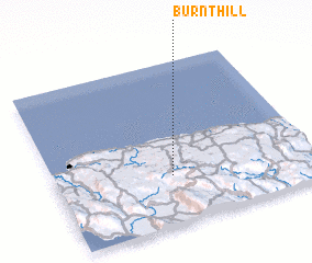 Places with similar names to Burnt Hill, Jamaica ::
// Bärnthal (AT)
// Burnt Hill (US)
// Bärnthal (DE)
// Birnthal (DE)
// Brünnthal (DE)
// Brunnthal (DE)
// Brunnthal (DE)
// Burnt Hill (US)
// Brant Hill (US)
// Baerenthal (FR)
Disclaimer :: Information on this page comes without warranty of any kind |
||
|
Where is Burnt Hill? Elevation and coordinates ::
Latitude (lat): 18°18'0"N Longitude (lon): 77°33'0"W
Elevation (approx.): 649m (map arrows pan, magnifying glasses zoom) |
||
|
Visiting Burnt Hill? Hotel/Accommodation ::
Book a hotel in Burnt Hill Travel Guide ::
Buy a travel guide for Jamaica rental cars ::
car rental offers GPS waypoint ::
download a GPX waypoint (PoI) of Burnt Hill for your GPS receiver
|
||