|
search place name
|
||
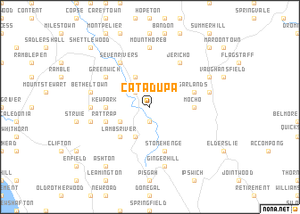
Catadupa (Saint James, Jamaica)Catadupa is a town in the Saint James region of Jamaica. An overview map of the region around Catadupa is displayed below.
regional and 3d topo map of Catadupa, Jamaica ::
Catadupa airports ::
The nearest airport is MBJ - Montego Bay Sangster Intl, located 24.6 km north of Catadupa.
Other airports nearby include OCJ - Ocho Rios Boscobel (97.6 km east), KTP - Kingston Tinson Pen (116.8 km east), KIN - Kingston Norman Manley Intl (122.2 km east), POT - Port Antonio Ken Jones (143.0 km east), Nearby towns ::
Hermitage (1.9km south) //
Cottage (2.6km north west) //
Seaford Town (4.1km south west) //
Saint Leonards (4.1km south west) //
Kan Pan (4.0km south west) //
Cambridge (4.1km north west) //
Lambs River (5.1km south west) //
Fornbrook (5.3km west) //
Mocho (5.3km east) //
Kew Park (5.3km west) //
Rat Trap (5.6km west) //
Stonehenge (5.8km south) //
Garlands (5.6km east) //
Jericho (6.6km north east) //
Seven Rivers (6.6km north west) //
Belvedere (6.5km north west) //
Greenwich (6.5km north west) //
York (7.0km west) //
Mount Horeb (7.4km north) //
Ginger Hill (7.6km south) //
Caley (7.3km east) //
Barneyside (7.3km west) //
Bethel Town (7.3km west) //
Flamstead (8.0km north east) //
Ashton (9.1km south west) //
Prospect (10.2km north east) //
Point (10.2km north east) //
Maldon Village (10.2km north east) //
Shettlewood (10.2km north west) //
[all distances 'as the bird flies' and approximate] 
Disclaimer :: Information on this page comes without warranty of any kind |
||
|
Where is Catadupa? Elevation and coordinates ::
Latitude (lat): 18°17'0"N Longitude (lon): 77°53'0"W
Elevation (approx.): 216m (map arrows pan, magnifying glasses zoom) |
||
|
Visiting Catadupa? Hotel/Accommodation ::
Book a hotel in Catadupa Travel Guide ::
Buy a travel guide for Jamaica rental cars ::
car rental offers GPS waypoint ::
download a GPX waypoint (PoI) of Catadupa for your GPS receiver
|
||